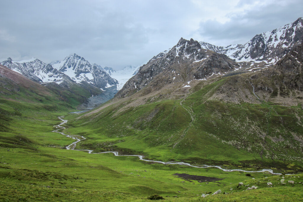
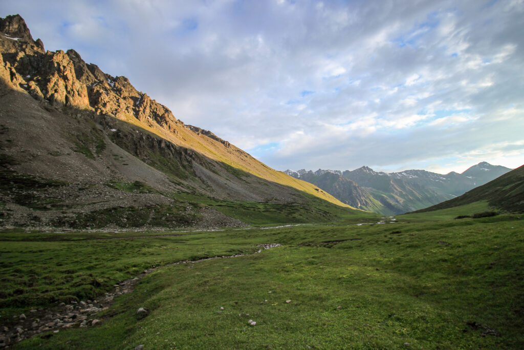
Nestled in the heart of Central Asia, the Ak-Suu Traverse is a hidden gem for avid hikers and adventure seekers. This 110km trail, winding through the rugged Tian Shan mountains of Kyrgyzstan, takes you through one of the world’s most pristine and untouched landscapes. Starting from the picturesque village of Jyrgalan and ending in Jeti-Öguz, the Ak-Suu Traverse winds through alpine meadows, over high mountain passes, and through lush valleys dotted with crystal-clear lakes.
This trail is very challenging and typically takes 9 days to actually complete. But it can easily be broken into smaller, more manageable chunks if you only have a few days.
Ak-Suu Traverse Overview
- Location: Tien Shan Mountains in Eastern Kyrgyzstan
- Length: 110 km
- Elevation gain: +7155m
- Elevation loss: -7465m
- Time: 7 days (no breaks), but 9 or 10 days if you are realistic
- Best time to Go: July to early September
- Sleeping: Camping or Prebooked Yurts
- Closest city: Karakol
- Start: Jyrgalan
- Finish: Jeti-Öguz
- Difficulty: Very challenging
- 7-Day Version Map Link
- 6-Day Version Map Link
Our Time Trekking on the Ak-Suu Traverse
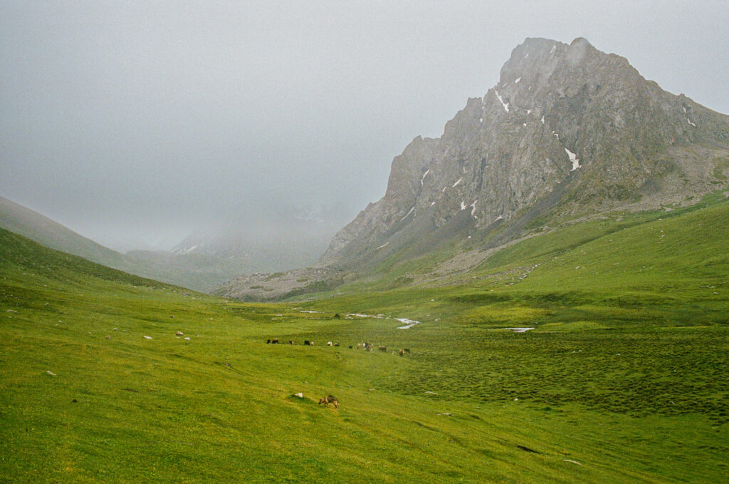
Initially, our plan had been to hike in 6 days from Boz Uchuk town to Jeti-Öguz Resort, but in the end we had to modify the route. We planned it based on our past experience hiking in South Africa, the Dolomites, and Reunion Island. However, we did not factor in how seriously the elevation would affect our pace nor did we anticipate the storms we might face. As we planned our hike for the second to last week of June, we knew that there might be some snow still on the passes and that the nights might be colder than they would be in July or August.
Before we set off, we checked the weather forecast for the next few days (it didn’t look amazing, but it also didn’t look dangerous) and asked at Destination Karakol for the latest information on the trail conditions. They told us Telety Pass was still in snow and that no one had managed it yet this season. We didn’t want to be the first to test it so, before we set off, we decided we’d end our hike at Karakol Valley.
Day 1: Boz Uchuk Valley to Boz Uchuk Lakes
- Distance: 18.2 km
- Elevation gain: 1490 m
- Elevation loss: 10 m
- Map Link
This day is pretty easy – you start off following a jeep track past a small ski resort. The road eventually crosses a larger river via a wooden bridge. From here, the jeep track is gone and you will follow animal tracks up the valley.
At one point, there’s a bridge that crosses back over the river and a worn path leading up the valley from there on the righthand side. If you spot that bridge, head to it and use it to cross over.
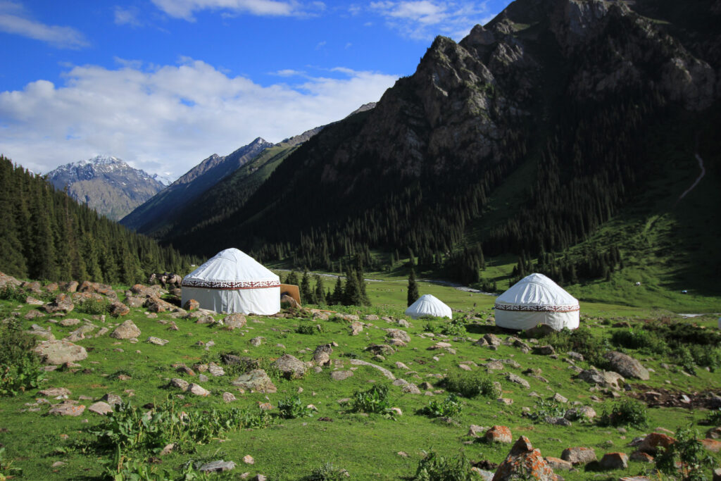
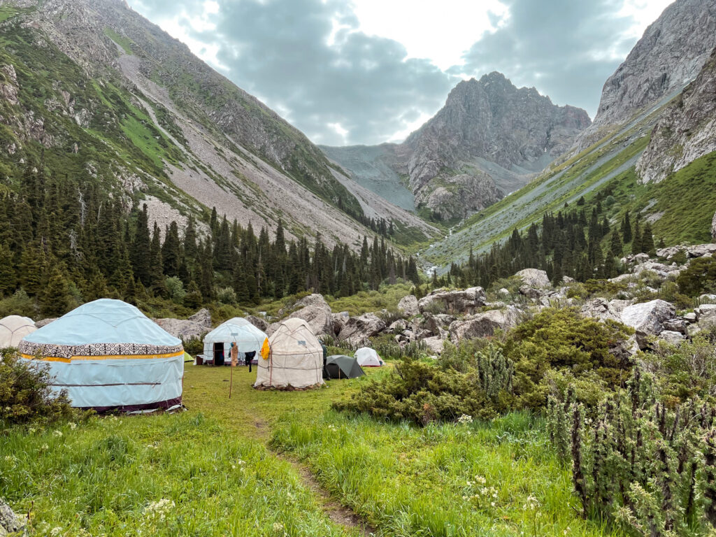
If you don’t see that bridge, you’ll keep walking up the valley, along the lefthand side of the river. You should see a yurt camp eventually to one side and a steep slope with a stream rushing down it. The Boz Uchuk Lakes are 100m above where you are. If you want to camp by the yurts, you will need to cross over the river up by the yurt camp – it’s just quite swampy and a bit tricky to stay dry.

We stayed by the yurts (and were invited to stay for free in the yurt for the night) because of the oncoming rain and thunderstorms.
Alternatively, if you want to camp by the lakes, cross the river near the yurts, and follow the worn path towards a zigzag path up to the lakes. There are quite a few flat spots up there for a tent, but there may be more wind and cold than by the yurts.

Day 2: Boz Uchuk Lakes to the Ak Suu Alamu Valley
- Distance: 17.6 km (but actually 22 km due to detours)
- Elevation gain: 770 m
- Elevation loss: 1370 m
- Map Link
This is the hardest day and you might be better off splitting it into two days and camping at the next set of lakes rather than in the following valley.
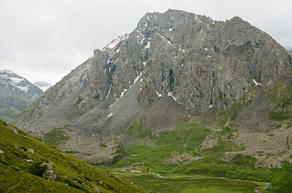
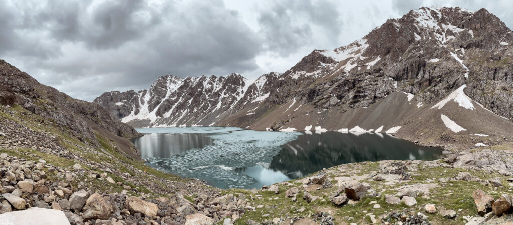
The day starts with the first mountain pass of Day 2 (3500m). We first visited the lake for photos (where we heard, but did not see, an avalanche) before heading up a trail to the pass. There was snow still when we crossed, but it was manageable to walk around. From there we walked into a valley where we crossed a small river and then had another small river ahead of us to cross. However, a massive hail storm swept in along with thunder hovering on the next pass we needed to cross.
So we hid under our ponchos and waited. Bad idea. The river by this point had become a lot wilder and we had to walk a while upstream before we found a safer point to cross. We had to take our boots off to cross and were completely frozen by the time we reached the other side. From there we made our own way up a very slippery hail-covered slope until we connected with a trail leading over the mountian pass (also had some snow). From here you can see the Alianyash Lakes just about straight ahead of you.
From here, we followed muddy trails down into the valley and crossed yet another river after a long detour upstream to find a safe crossing point. From there, there was a steep ascent up the grassy slope towards the Alianyash Lakes which you would have seen from the last pass you crossed.
By this point, it was 5pm and we only had 3 hours of sunlight left. The lakes were surrounded by snowy, rocky mountains and the ground was covered in snow and hail – it was very, very cold. And also rather eeire so we decided to keep going to the next valley.
We begun hiking up to the last pass (3671m) when an avalanche occurred to our left by one of the lakes. Feeling reinvigorated and motivated to get out of there, we slogged through snow and scaled the pass (also a lot of snow up there). We were dead tired at this point having been hiking with very heavy packs pretty much non-stop since 9am.

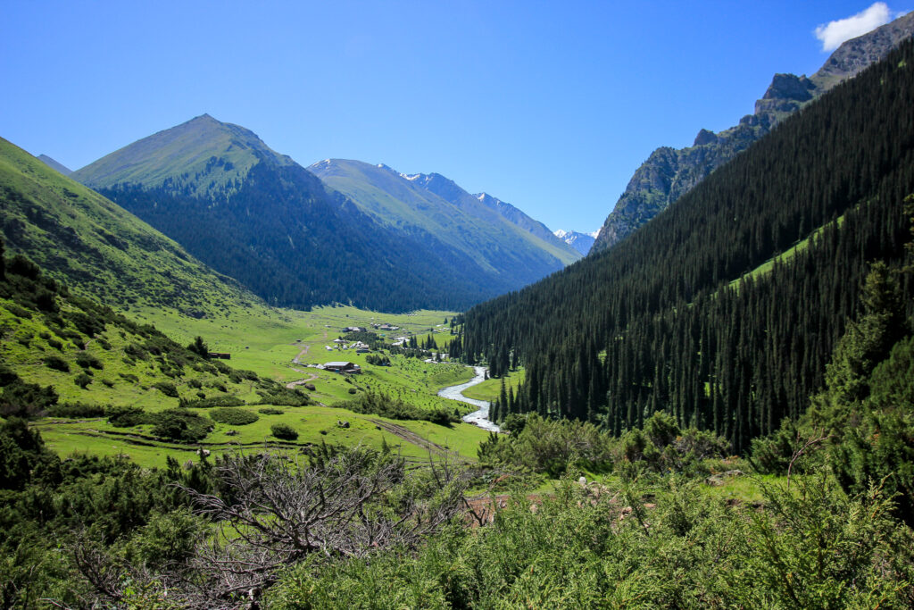
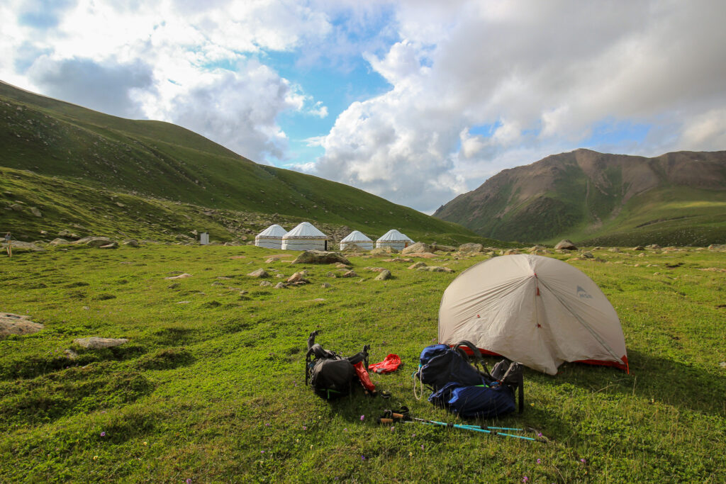
We followed some old footprints in the snow off of the mountain and into a green valley with a fantastic view of a massive glacier. We turn right to follow the valley high above a river. By this point it was getting dark, so we needed to hike the last hour in headlamps. We passed a yurt camp with no people – we’d suggest camping here given the flat ground.
We instead hiked to the wooden bridge where the next day’s hike would start from. There were no other people around but there were plenty of empty shepard huts and shepards’ guard dogs which freaked us out a little. So we found an area away from the dogs, but relatively flat to camp.
The river water is very silty, so you’ll want a filter. Otherwise, there is clear water in a stream across the bridge near the shepard hut.
Day 3: Ak Suu Alamu Valley to Altyn Arashan
- Distance: 12.6 km
- Elevation gain: 830 m
- Elevation loss: 1060 m
- Map Link
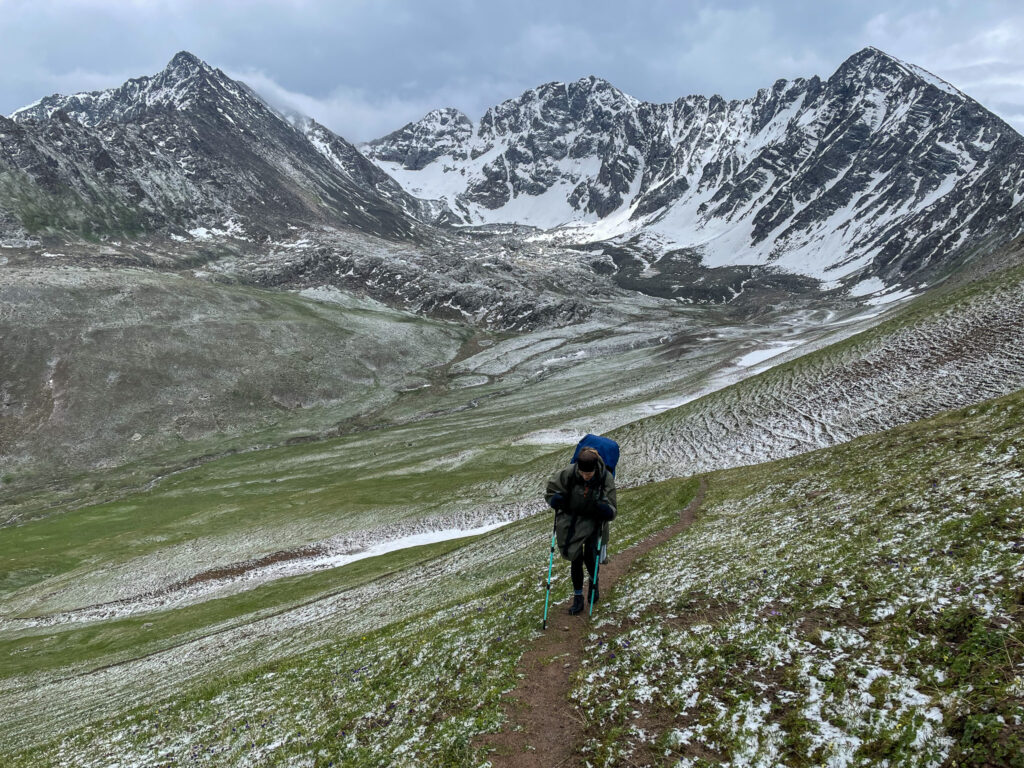
Having learnt from our previous mistakes, we set off much earlier today to beat the inevitable afternoon thunder and hail storm. We got going at around 8 and made it up the 3569m mountain pass by noon. The hike was a massive slog up – it’s steep, the air is thin, and there was a rather dangerous snow bank along the pass precariously perched on unstable rock.

As we were decending, the storm clouded over the pass and it begun hailing and then raining like crazy. We hid under our ponchos by a massive boulder for the worst of the storm to pass. When we reemerged, we found ourselves surrounded by hundreds of goats.
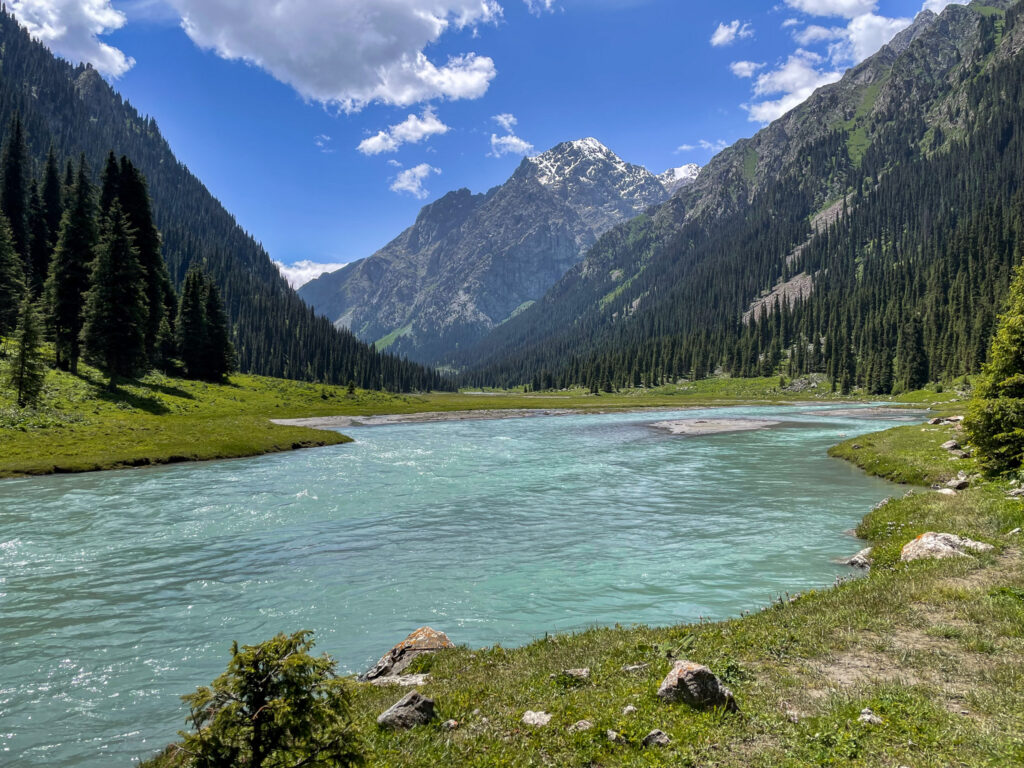
The last descent of the day took longer than we expected – the first bit was very gradual, along a long stretch of the valley before it dropped a lot more steeply after passing a waterfall.
Just before the steeper ascent out of the valley, the river widens out and is a great spot for a dip, if it’s sunny.
The final stretch reconnects with a jeep track that brings you into Altyn Arashan. If you’re camping, you can set up anywhere – generally the guesthouses will let you camp on their property as well. If you don’t want to camp, there are plenty of guesthouses to choose from – in June, you wouldn’t need to prebook, but you might in July or August.
I highly recommend taking time to relax in one of the hot springs. There are multiple hot springs you can visit for very cheap – 300 SOM (bring cash). You get a key and then you have the whole hot spring for yourself. If you go in the evening, there’s generally less of a queue.
Day 4: Altyn Arashan to Karakol
- Distance: 17.2 km
- Elevation gain: 139 m
- Elevation loss: 760 m
This day was one of the most boring of the trek. We hadn’t planned to do it, but we were also not keen on our original plan – hiking up to Ala-Kul. We heard there was hip deep snow on the pass and so the only option was to take a soul-shatteringly steep alternative route. Our heavy bags were getting to us and I was struggling with breathing again, having not fully recovered from COVID two weeks before and redeveloping some sort of chest infection. So we decided to skip the 3900m pass and attempt Ala-Kul from the lower pass from Karakol Valley.
We hiked along the jeep track for what felt like a lifetime to a tarred road near Ak-Suu village where we caught a taxi back to Karakol. The walk was unmemorable and we had to step aside for many tourist jeeps to pass. We’d highly recommend rather catching a ride back from Altyn Arashan to skip this walk.
Back in Karakol, we found an empty room at Matsunoki and had very strange, but nice sushi and pizza at SushiSet. We unloaded a bunch of extra food we wouldn’t need for the next two days.
Day 5: Karakol Valley to Ala-Kul Lake / Sirota Camp
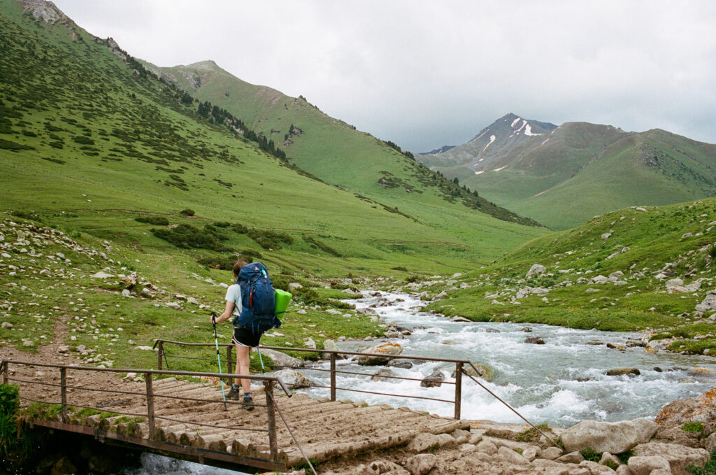
After breakfast, we got a taxi up near the first bridge in Karakol Valley for 800 SOM. We had to walk another 30 minutes to get to the wooden bridge crossing the river. From here we followed a jeep track for several kilometres before we got to a wooden suspension bridge to our left. There are quite a few other hikers on the trail (it’s not crowded, but we saw people about every hour).
It takes another 1.5 hours to get to the Sirota Camp, where two yurt camps can be found as well as flat ground for pitching a tent. Since we arrived around 3pm, we figured we would set up the tent, throw our stuff inside, and hike that afternoon up to the lake. We found that there were good weather windows in the mornings and just before sunset, and storms in between.
And we still had a little energy, so with lightened bags, we hiked up to the lake. It took about 2 hours even though it was only 600m of elevation gain. After passing a waterfall, the greenery gives way to rock, and from there it gets very steep and slippery. We took the path to the left going up but would recommend the route on the boulders following the cairns to the right.
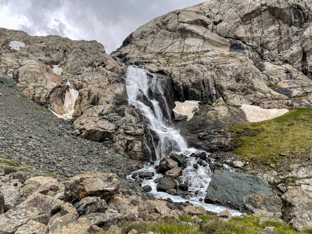
It was difficult, even with little weight, because of the elevation and days of hiking behind us. But once we ascended past the last waterfall, the lake was quite pretty to see. It was still partially frozen when we were there. We could see stone windbreakers built to protect campers near the lake, but no one camped there when we visited (the weather wasn’t great).
The view from this point is only of part of the lake – to see the full thing, you’d have to hike higher towards the 3900m pass. Regardless, it was still photogenic from where we stood, so we didn’t feel like we missed out too much.
With a storm coming, we quickly descended via the boulder route back to Sirota camp, just as a massive hail storm crashed down on us.
Day 6: Sirota Camp to Karakol
- Distance: 14.6 km
- Elevation gain: 30 m
- Elevation loss: 930 m
- Map Link
After a quick breakfast, we packed up and made our way back down the mountain to get back to Karakol. We passed many hikers on the way and chatted for a while with many of them. Distracted, we didn’t notice the massive storm that had come into the valley and had to quickly cover the last few kilometres.
Despite our best efforts, we got caught in the downpour. As we came to the wooden bridge to cross, we saw it had started breaking. The one side of the bridge had cracked down towards what was now a very swollen and fast river. The cars on the other side were stuck and couldn’t cross, but we were light enough to quickly make our way back to the other side.
Once we had some cellphone signal again (past the first bridge), we contacted a driver and got a lift back to Karakol in the pouring rain and hectic thunder.
Planning to Hike the Ak-Suu Traverse
Is this hike for you?
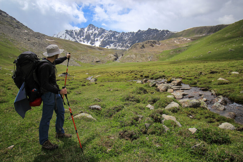
This is a challenging hike, so you would need to be fit, and above all have mental willpower. If you’ve done a 2-day hike before (back to back) that was at least 30 km long in total, with elevation, then you’ll know what pain you are in for. The distances are long, so we will need to hike at a moderate, uninterrupted pace for at least an hour to two at a time. You’ll also be camping, so knowing what bad sleep feels like will prepare you too. Trekking bags are very heavy, but you can practice in advance with heavy packs.
How long does it really take to hike the Ak-Suu Traverse?
Technically, you can do the Ak-Suu Traverse in 7 days. Is it a good idea? No. Even if you’re fit, you’ll want to build in rest days. Most take a day off in Altyn Arashan where the hot springs are. Alternatively, many also reduce the distances hiked each day. For example, the day from Boz-Uchuk lakes is an absolute killer (there are three mountain passes). We didn’t meet a single hiker who thought it was easy. There’s a possibility to break that day in two and camp at lakes instead of in the following valley
The official route begins in Jyrgalan. This allows you to acclimatise at 2,477m in Jyrgalan, where the official trail starts. It also brings you up the mountain slower to let you acclimatise along the way by setting up camp after day 1 at 3085m instead of 3482m at the Boz-Uchuk Lakes (as is the case on Day 1 on the alternate version we planned). However, Day 2 has a large descent, which tends to be a lot harder on the body than ascents. The version starting in Boz Uchuk valley avoids this massive descent and cuts down one day’s worth of food that you’d need to carry, making the hiking easier. But there’s a higher risk of altitude sickness.
Are there any other blogs about the hike so I can see my options?
This guy has the 6-day version of this hike. Here’s a pdf description of the 7-day version and here is a blog about doing the longer version of this hike (also great for seeing more photos). And another of the 7-day version.
When is the best time to do the Ak-Suu Traverse?
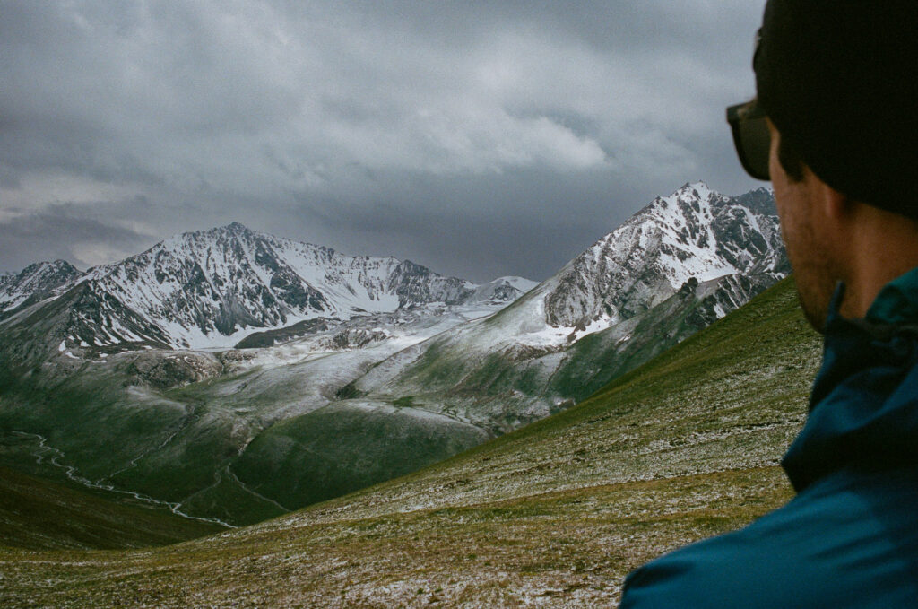
A lot of sources will tell you mid-June to early September. I would argue though, if you want to definitely hike the full route, it’s only really possible from mid-July to August given the snow on the passes.
We went in the second to last week of June 2024 and there was snow on the 3900m pass before Ala-Kul, forcing people to reroute to a much steeper and more dangerous crossing over to the lake. And there was too much snow in Telety Pass to cross into the next valley. We had snow on the other passes as well, but it was manageable. However, we could hear (and see) avalanches and the river crossing were a greater challenge given the snow melt.
How can I check the trail condition?
You can monitor the snow levels using the satellite imagery before you set off if you are planning to hike outside the July/August window. You can view it here.
If there are no marked trails, do I need a guide?
You can certainly book a guide or go with a group tour, but it’s expensive. If you have hiking experience in places without marked trails, you should be okay to do this trek following GPS tracks on your phone. I’d have a paper map and a compass, in any case, as a backup. You can buy a paper map for about 500SOM from Destination Karakol (blue building near Russian Orthodox church, opens at 10am, closed Sundays) in Karakol.
If using a phone to navigate, bring a good powerbank with. We slept with our electronics in our sleeping bags at night to keep the batteries from dying overnight in the cold.
How much will it cost?
Other than the small entrance fee that you may or may not have to pay at the park’s entrance and minimal costs for transport (public buses or taxi), the hike is free. We didn’t pay a fee. You don’t need to pay to camp and if you have all the gear, you won’t need to rent any.
How do I get to Karakol?
Kyrgyzstan is accessible via a network of hundreds of marshrutkas. These are the most affordable way to get around (besides hitchhiking).
From Bishkek: The bus to Karakol from Bishkek runs all day, but it is best to get there in the morning. The vehicle leaves only once it fills up all seats. The ticket is 500 SOM per person. There’s a 20 minute break and a bathroom stop at a clean rest stop 2 hrs into the journey. Toilets are 10 SOM to use. Get toilet paper from the toilet person before going to the bathroom. There are shops with semi-cold drinks, snacks and even ice cream. The bus terminates on the edge of Karakol, from where you can get a Yandex Taxi to your accommodation for a few hundred SOM.
Note: From Karakol, there is a 4pm bus direct to Almaty in Kazakhstan. If you want to visit Song-Kol lake, there is a bus that runs direct from Karakol to Chaek for 550 SOM (plus 200 SOM per large bag). The bus follows the north side of Issy-kul and passes through Kochkor and Kyzart. It leaves from Karakol at 8:35am (it does not need to be full to leave).
How do I get to the trail start?
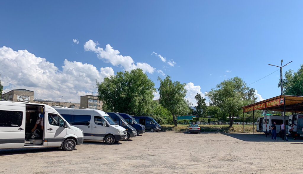
There are marshrutkas from Karakol in the mornings you can take to the trailhead. We ended up getting a lift with our guesthouse owner to Boz Uchuk. You can also pre-arrange a taxi for roughly 3200SOM to Jyrgalan and 2500SOM to Boz Uchuk (Yandex Taxi drivers won’t want to bring you there for the Yandex fee).
What is the accommodation like on the trek?
Most people choose to carry their own tents. Tents allow more flexibility in where you can stay along the trail, plus it’s free accommodation. We have the MSR Hubba Hubba NX 2-Person Backpacking Tent – it’s pricey, but it pays for itself after a few nights and hikes.
Alternatively, you can stay in yurts along the way. There is a yurt camp at Jyrgalan, Boz-Uchuk, Jergez, Almaluu, Altyn Arashan, Keldike, Ala-Kul, Karakol Gorge, Telety, and Kok-Jaiyk. It costs about 2500 SOM per person per night, and they often have sleeping bags for you to use. Though, just remember, they don’t wash sleeping bags or sheets, so you might want to pack a sleeping bag liner. Guests can pay for dinner, breakfast and even a lunch box for the day.

What will the weather be like?
Unpredictable. We got hailed on, rained on and thundered on. I think we may have gotten some of the worst weather for June in a long time.
At those elevations you’ll need winter clothing in case of snow, good waterproof boots, and camping gear that can handle the elements (3-season tent and a sleeping bag that goes down to -5C). To reduce the chance of getting caught out in a storm, we always aimed to get over the highest mountain pass before noon.

Is it safe?
Kyrgyzstan is very safe. The hike comes with risks though. For one, there’s no mountain rescue, there are very few people, and the trails are not marked, which is why we would need to stick together from start to end of the trail. It’s really important that you accurately assess whether you think you can do this hike. Of course, unexpected things can happen – like a twisted ankle which is why hiking with at least one other person is good. There will be river crossings – for the most part, there are bridges, but otherwise you might need to walk across or pay to use a horse.
What is altitude sickness?
This is a life-threatening situation that can unexpectedly affect you (even if you are super fit) at elevations of above 2,500m. To mitigate this, you need to give your body time to acclimatize (generally overnight, and camping at heights not more than +500m apart at a time). If you have severe symptoms, then you will need to drop elevation. This is why you will want to spend 1-2 nights at above 2000m before you start hiking.
What do I need to pack?
This was traditionally a fully self-supported hike. However, there are now yurts along the route for tourist hikers to stay at (though you may want to let them know ahead of time that you are coming so there’s food for you when you arrive).
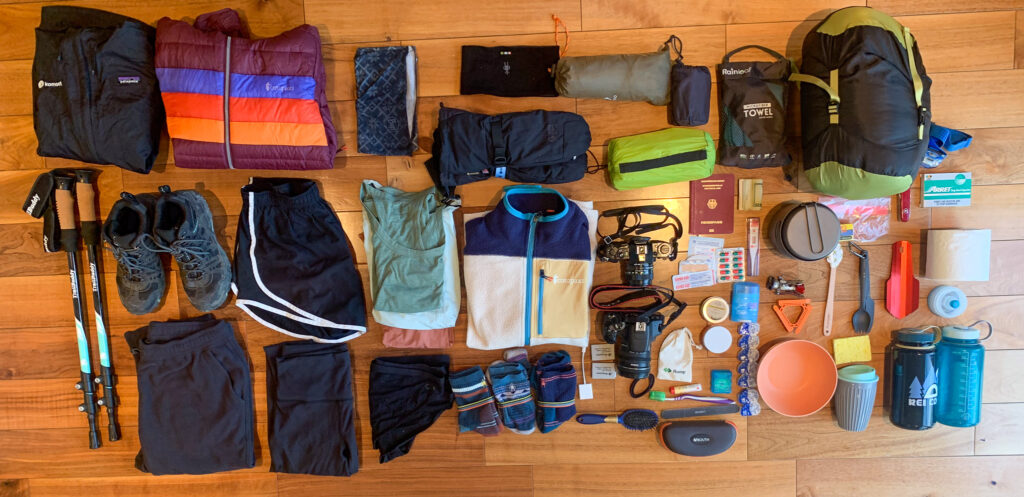
For everyone camping in their own tents and carrying their own food – there increased access to accommodation options and cooked meals from Altyn Arashan to Jeti-Öguz. Plan to carry all of your camping gear, cooking gear, food (for at least 4 days at roughly 1kg a day, assuming a re-supply is arranged at Altyn Arashan, and otherwise 9 days of food), and other items. Expect to carry around 15-20kg, depending on what you choose to bring. You can rent several pieces of hiking equipment, like a tent, in Karakol.
I packed the following items:
First Aid
- blister bandaids
- normal bandaids
- gauze
- thermometer
- anti-diahheral pills
- fever tablets (Myprodol and Tylenol)
- water purifying tablets
- Swiss army knife
Toiletries
- toothbrush
- toothpaste tablets
- floss
- conditioner bar (didn’t end up using)
- shampoo bar
- deodorant
- chapstick with 15 SPF
- 7 pairs of daily contacts
- sunglasses
- glasses
- hairbands
- hairbrush
- quick dry towel
- trowel
- biodegradable toilet paper
Cooking
- alumninum cooking pot and pan
- plastic bowl
- spork and knife set
- mini rubber spatula
- camping fuel (227g is enough for 6 days for 2 people if all your food requires only a minute of boiling water; we bought this in Bishkek)
- camping fuel stove attachment – we used the MSR Pocketrocket
- plastic tripod for stove
- titanium pot with pan
- matches (in a dry bag)
- Lighter (keep in a dry bag)
- plastic cup and lid
- 2 Nalgene water bottles
- water bottle filter
Personal Items
- camera – digital
- camera – film
- SD card to phone transfer cable
- 2 spare camera batteries
- Power bank (for 6 full charges) and phone cable
- wad of USD cash and SOMs
- passport
- hiking poles with snow attachments
- 60-80L backpack (I have a small torso, so I use Gregory Deva 70 Pack)
Camping gear
- inflatable pillow
- inflatable mat (4-seasons can be helpful; we have Therm-a-rest mats which were a bit bulky)
- Nemo Riff 15 Endless Promise Down Sleeping Bag (-5C recommend, mine went down to -18C):
- headlamp
Clothing
- Rain poncho
- Patagonia rain/wind jacket
- Cotopaxi down jacket
- Nike hiking shorts
- Lululemon hiking pants
- REI fleece leggings
- 2x Smartwool underwear
- Underarmour sports bra
- 2x Smartwool t-shirts
- 1x Patagonia hiking tank top
- buff
- Smartwool headband
- Cotopaxi fleece
- 3x crew cut Smartwool socks
- GTX hiking mittens
- 3 pair Merino wool hiking socks (I prefer heavy cushioned Smartwool socks)
- GTX hiking boots (I used Merrells)
- Gaitors (We didn’t have these, but wished we did to keep our feet dry)
What food do I need to pack?
You should pack enough food for each day, plus a spare day. We planned to hike only 6 days, and so carried 7 days of food between us. We were not very hungry at the higher altitude, and so the more filling foods (e.g. pasta) were not appetising for us – we preferred the calorie-dense foods like Clif bars, nuts, and chocolate.
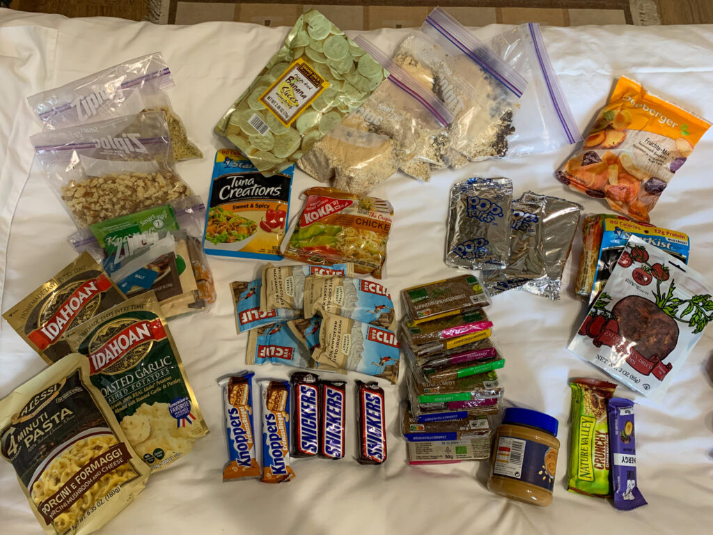
For breakfast, we had an oatmeal mix – 75g of quick cooking oats, 12g of peanut powder, 25g raisins, and 12.5g of seed mix, plus a pinch of salt and cinnamon for flavour. We also found some freeze-dried banana slices at Trader Joes to throw on top.
For lunch and snacks each day, we had 1 Clif bar, 1 pop tart, 1 chocolate bar, nuts/dried fruits, cup of soup packets, and high-fibre German bread with peanut butter. Since the weather was bad and we didn’t have any appetite, we only really ended up eating the Clif bar and chocolate bar during the days. The bread was very heavy, and we could have done with half. We also carried cheese and salami for the first 4 days (which held fine in the cold temperatures).
For dinner, we had three meal options. We found a 4-minute pasta mix in the US, but many also swear by Knorr sides. Another self-made meal was a packet of Idahoan mashed potatoes (one packet per two people) and 56g of stuffing mix per person (we also had gravy packets with, but didn’t use these because of the effort required). The final meal was ramen noodles (2 per person), sun dried tomatoes and a Starkist tuna creations packet. The tuna packets were useful also for spreading on bread.
Do I need a visa?
Probably, no if you are from the EU, UK or US. But if you are from South Africa, yes – you can apply online for a single-entry visa for 50USD (multi-entry does not work).
Note, some hikes that get too close to the Chinese border require a border permit to hike in the area.