With hundreds of trails weaving across mountains, gorges, beaches, and waterfalls, you’ll be spoilt for choice on Réunion Island. Unless you move to the island (why not?), you’ll only have enough time for a handful of hikes.
The best way to experience Réunion is by spending several days on one of its many hiking trails. But if a multi-day hike isn’t your thing, then these are three of our favourite day hikes on the island. Each one will give you a different flavour.
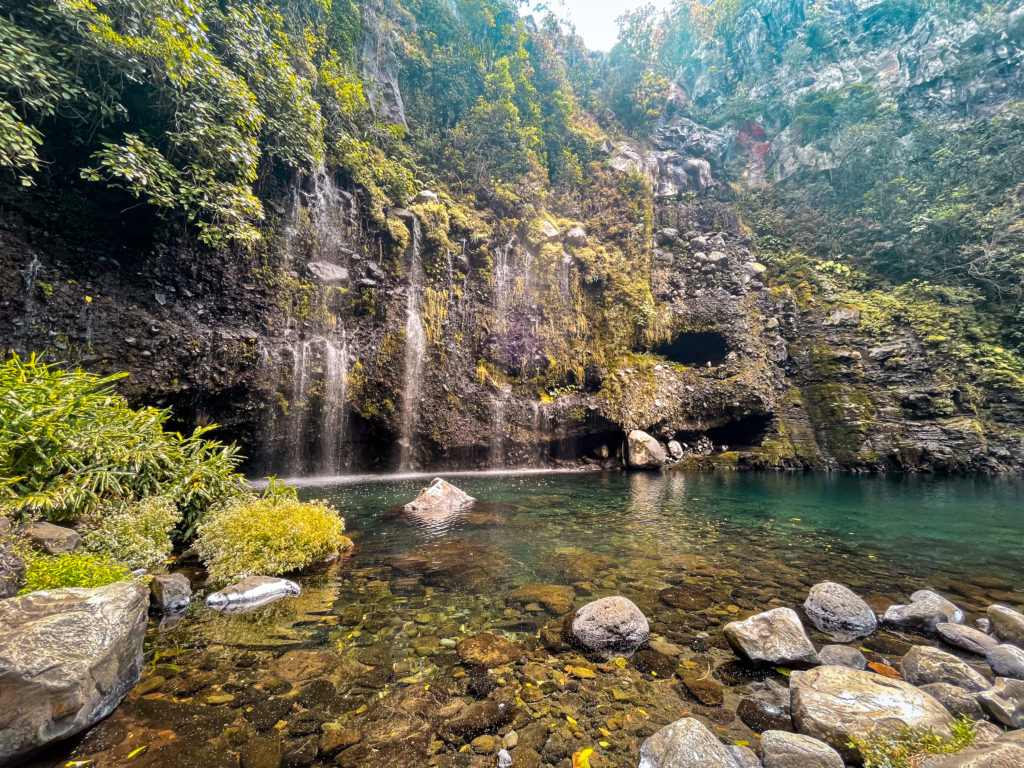
Hike Grand Bassin Waterfall for a Refreshing Swim
Hike Overview
- Length: 11 km
- Elevation gain: +880m
- Elevation loss: -880m
- Shade factor: Some
- Water availability: At the start/end and midpoint of the hike
- Map Link: Komoot Map
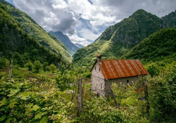
Grand Bassin is not necessarily the grandest of swimming basins on Réunion Island, but it has without a doubt the most beautiful hike to get there. If you are keen to see the waterfall in all its glory, its best to plan your trip there shortly after the rainy season. When we went in late September, the water was more of a trickle than a steady flow.
The hike starts off at the viewpoint overlooking a small hamlet that you can access from La Plaine des Cafres. There are picnic tables and toilets available here. The parking lot is quite big and you’ll have no issue finding a spot on the weekdays. But weekends likely fill up with locals visiting for a picnic.
From the viewpoint, you’ll head left to a dusty flat trail. This will take you along a 6km hike to the waterfall with 750m of descent. The path isn’t well shaded, so starting early is advisable. Once in the hamlet, follow signs towards Grand Bassin. There are many little paths in the hamlet, but they’ll eventually lead you there. Keep following towards the left if in doubt. You’ll have to cross a stream by jumping from rock to rock or alternatively wading through. Then you’ll follow another path heading left and descend around to Grand Bassin. The last bit of the trail goes through thick reeds.
To head back, follow the trail you came on. Alternatively, you can spend the night in one of the many guesthouses in the village near the falls and hike back out the next day.
The best time of day to get to the basin is before 11am when you still have a chance of sun and clearer skies. We got there at noon just as the clouds were rolling over. Most people got there by 11 and the area was quite empty by 1pm. In any case, it never felt crowded – like most places in Reunion, the tourist traffic is minimal.
For more swimming spots in Réunion check out the dedicated post.
Hike to an Active Volcano: Piton de la Fournaise
Hike Overview
- Length: 12 km
- Elevation gain: +470m
- Elevation loss: -470m
- Shade factor: None
- Water availability: At the start/end of the hike
- Map Link: Komoot Map
Reunion is home to one of the world’s most active volcanoes. And on days where it’s not erupting, you can hike through a lava field and up to its one-kilometre wide crater. The best part is the hike is relatively flat. It will take you about 4 to 6 hours though since it is 12km long (there and back).
This volcano is especially famous for the view of the sunrise – the sun happens to rise right behind the famous crater. For your best chance of a view of the massive crater, make sure to be there before 9am when the clouds start rolling in. Ideally, get there by sunrise to see the sun rise behind the main crater.
As for the hike, it’s fairly straightforward. After driving through the lava fields (the road conditions are totally fine – a little sedan can handle the dirt road part without any issue), you’ll get to a massive parking lot. There are bathrooms, cafe and visitor centre here.
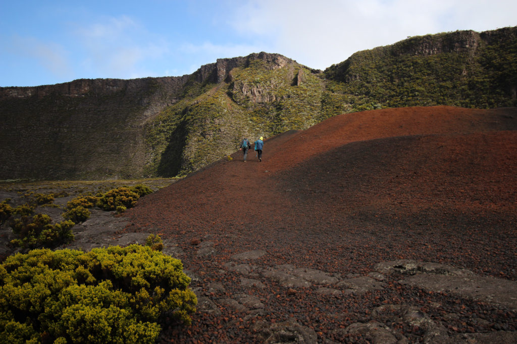
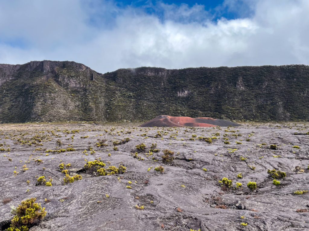
From the parking lot, you are on the rim of a massive crater. You’ll head left from the parking lot towards a stairway and trail that steeply descend into this crater towards Piton de la Fournaise. You’ll unlikely be the only one there so you can just follow the others. Otherwise, there are very helpful white dashed markings on the ground that you can follow to avoid losing your way.
The first point of interest you will pass is a small, very red crater. You can walk up and into it. After passing this, at one point, there is a fork in the trail where you will head to the left to continue up to the crater.
If you’re lucky, you’ll have a clear view across the crater. We weren’t lucky at all and even though we arrive before sunrise, we walked the whole way in massive thick clouds of fog, mist and rain and saw pretty much nothing.
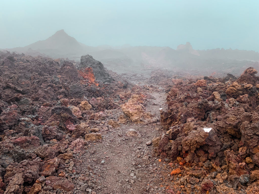
To do this hike, you’ll definitely want good shoes. Hard lava is quite sharp and you’ll notice on the ground many colourful little pieces of rubber from destroyed shoes of the hikers who came before you. Also bring plenty of warm clothes (gloves will help) and make sure to have rain gear – the weather conditions can change rapidly up here.
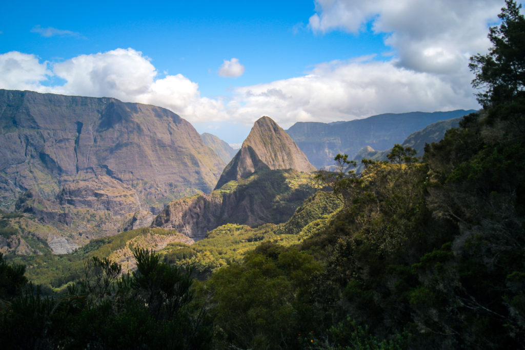
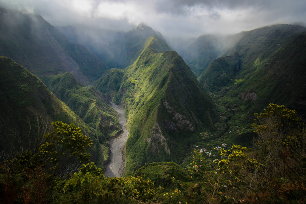
Hike Through Remote Villages in an Extinct Volcano: Cirque de Mafate
Hike Overview
- Length: 26 km
- Elevation gain: +1540m
- Elevation loss: -1540m
- Shade factor: Limited
- Water availability: Very limited
- Map Link: Komoot Map
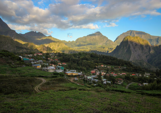
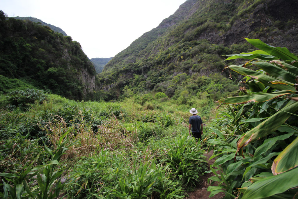
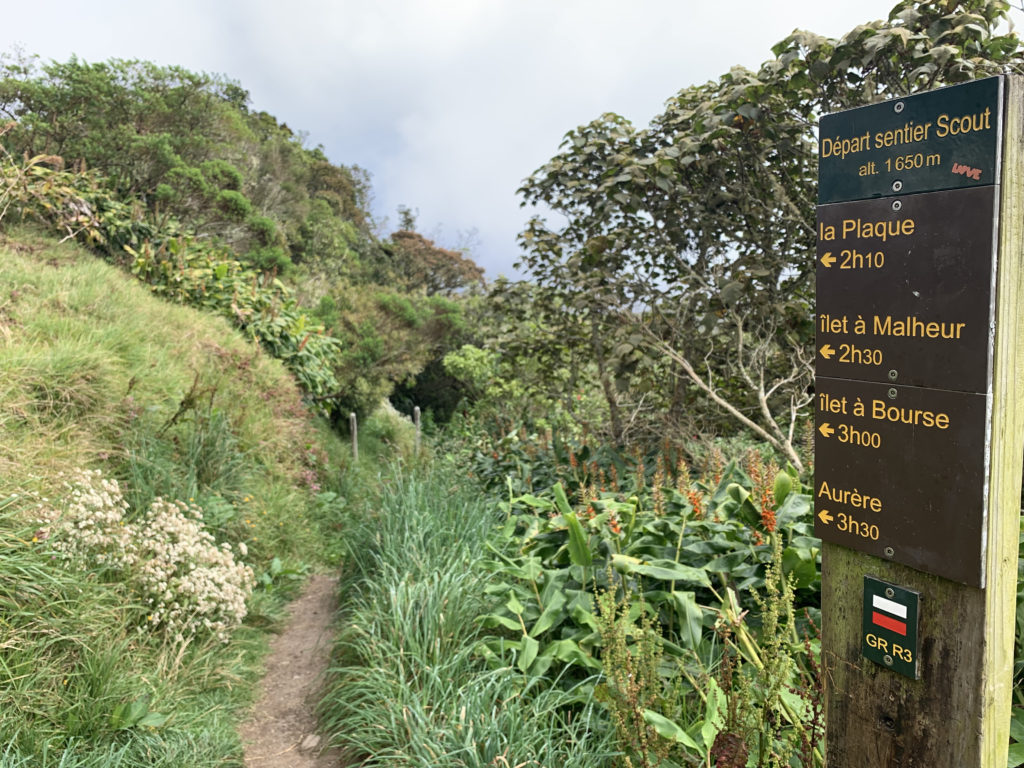
Cirque de Mafate has some of the most remote villages on the island, all of which are only accessible on foot or via helicopter. While you can easily see the Mafate from one of the viewpoints (like Maïdo), if you want to experience it, you’ll have to commit to a full day hike. One of the easiest and most jaw dropping routes into Mafate begins from Grand-Îlet in Cirque de Salazie. It takes about 6 hours round trip and is a there-and-back route to Ilet à Bourses.
You can hike up to the hike start from Grand-Îlet, but you’ll save yourself about an hour if you can get a ride to the parking lot at Parking du Sentier Augustave.
From Parking du Sentier Augustave, you’ll take the hiking path to your right and start descending into Mafate. The path heads through a tropical forest section and begins to descend. Every now and then you’ll catch a glimpse through the trees of epic views and peaks. Keep going – the view gets much better.
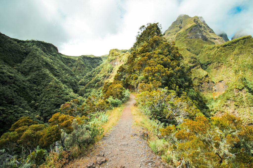
After you cross a stream, you’ll hike uphill to a saddle of sorts. The mountain drops steeply on both sides of the trail making this an exceptionally beautiful and thrilling part of the hike. After a bit you’ll descend through a steep forest path and cross a few more streams with massive, jurassic sized plants before a final ascent into Ilet à Bourses.
In Ilet à Bourses there is a small snack bar you can stop at for drinks and hot, fast foods. The food is decently priced and only a few euros more expensive than in the main towns, which is impressive given everything that got there arrived by helicopter. Alternatively, just near the snack bar, there’s a helicopter landing area that has a few picnic tables with a pretty nice view of a very triangular mountain formation.
To head back, follow the same path you used to get there.
If you like the idea of hiking through the cirques, but you want more than just a taster, maybe a multi-day hike is more your thing?