While Dublin is famous as the capital of Guinness and also as the ‘Emerald Isle’, a lesser known fun fact is that it has a number of cliffy coasts and a sizeable national park to the south. The coastal walks in Bray and Howth are two of the most popular routes for city dwellers, but many do not know that there are many more options if you are willing to hop on a bus. You can access several decent hiking routes around the Wicklow Mountains National park without a car of your own.
This is an evolving list of day walks and hikes in and around Dublin, Ireland that you can get to using public transport.
Howth cliff walk (loop), 6-12km
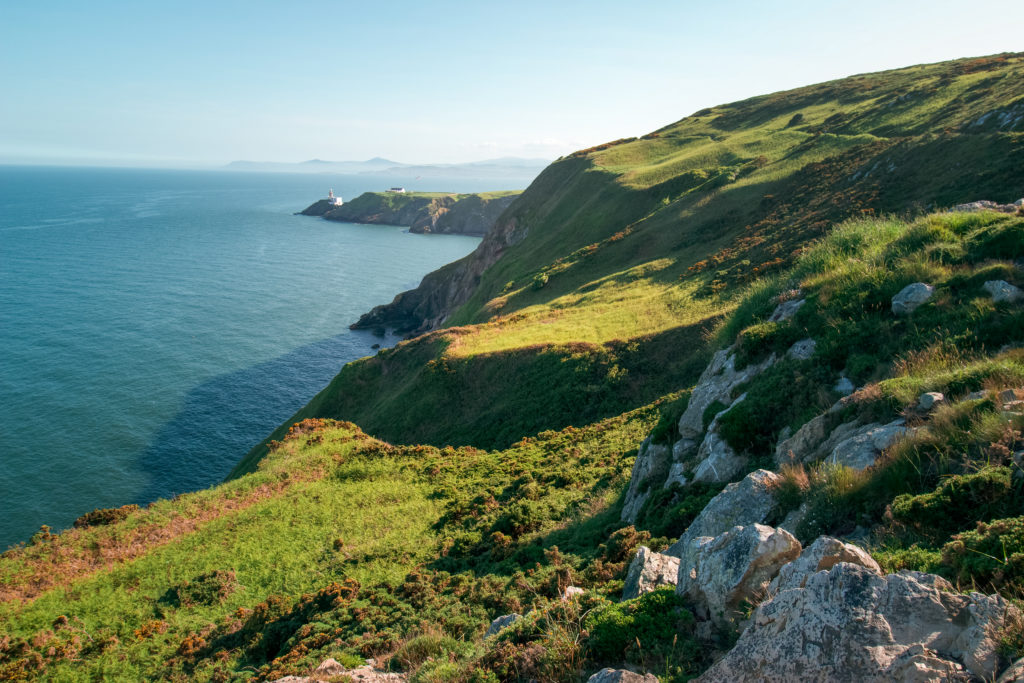
It’s generic, and everyone in Dublin does it, but it’s gorgeous. If you only have time for one hike in Dublin, then I would recommend doing a loop around Howth. There are four loop walks to choose from: the Green Route (6 km / 2 hours); the Blue Route (7 km / 2 hours); the Red Route (8km / 2.5 hours); and the Purple Route (12 km / 3 hours). The paths are well-signaged and start from the DART station in Howth.
The longest, and arguably most scenic, is the Purple Route. All routes take you to the view of the lighthouse, but the Purple Route takes you further along the coast, past hidden beaches and fancy houses.
How to get there
The quickest way to Howth from central Dublin is to take the DART towards Howth. The cost likely will be capped to the TFI 90-minute fare of €2. From Connolly station, the ride is about 30 minutes.
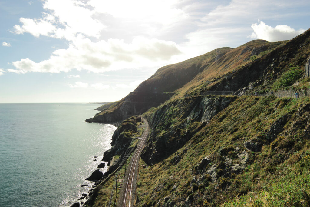
Bray to Greystones Cliff walk (loop), 10km
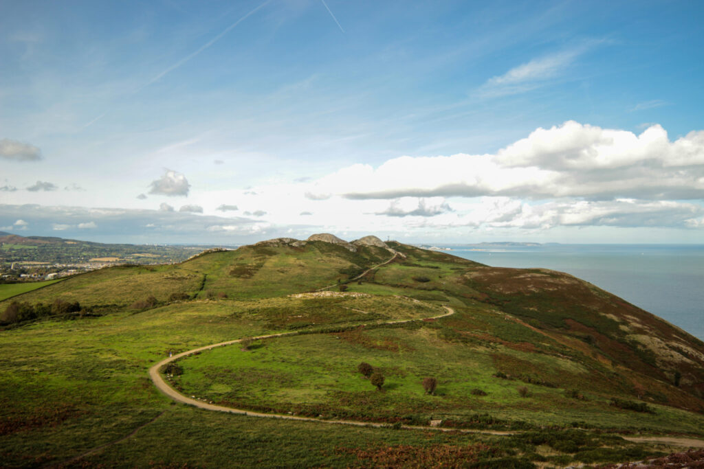
Perhaps one of the most popular walks in the Dublin area is the walk from Bray to Greystones. The coastal path route follows the cliffside from the southern part of Bray to Greystones in Wicklow County, with the DART running parallel below. You can walk the official 7km route, but we’d recommend walking along the paved path towards Greystones before diverting up the hill before you reach Greystones so that you can enjoy the views from the hills and Bray Head (241m). Once you head up here, it’s a lot less crowded and quieter – even though you’re still close to Dublin, you feel much more immersed in nature.
It’s a very easy walk that you can easily do in the morning before breakfast or in the evening for sunset. Follow along the route here.
How to get there
A number of buses head to Bray, but the fastest way is by DART. I’d recommend taking the DART to Bray and walking from there. If you head to Greystones (which is not in Dublin County), the fare price goes up from the capped TFI 90-minute fare of €2, because it is outside of the Dublin city fare zone area.
Great Sugar Loaf to Little Sugar Loaf to Bray (point-to-point), 18km
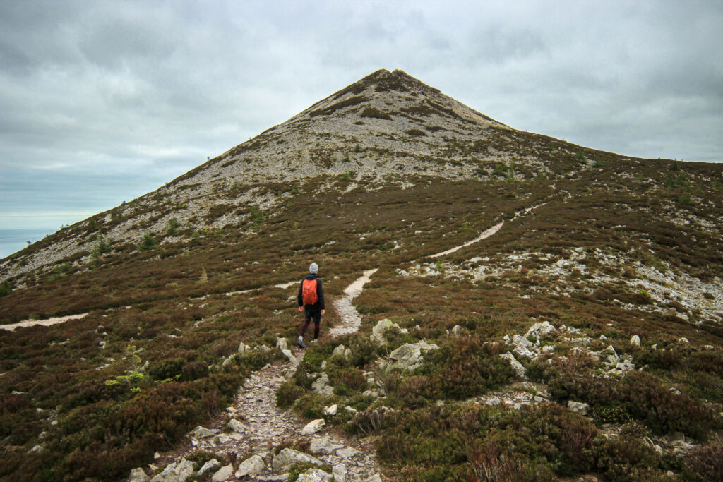
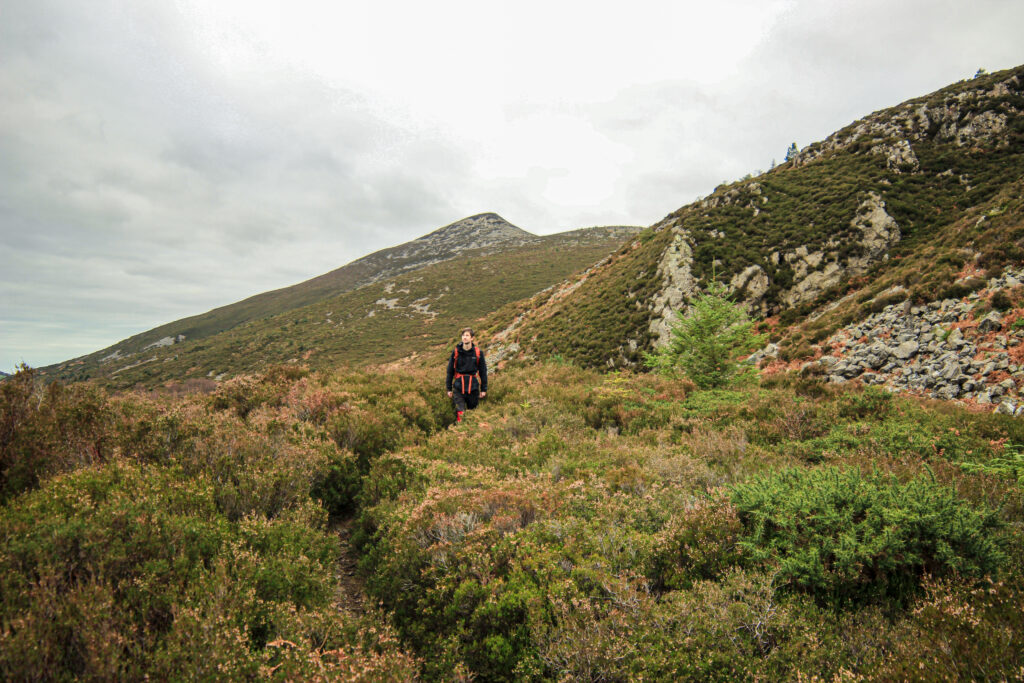
At 501 metres, Great Sugar Loaf is the 404th-highest mountain in Ireland, and one of the highest you can hike using a bus to get there. Laying at the far northeastern section of the Wicklow Mountains, Great Sugar Loaf gives off rugged rural Ireland vibes at various points. The trails along the Great Sugar Loaf base are some of the nicest I have seen so close to Dublin.
You can either only hike around Great Sugar Loaf or you can do the full route through to Bray via Little Sugar Loaf. From the bus stop in Kilmacanogue, you’ll head over the pedestrian bridge and walk along narrow roads for a short bit. From here you’ll quite quickly find yourself on dirt trails, walking through thick shrubs and somewhat boggy terrain (though if it recently rained, then bring those waterproof boots). Most of the hike up to the peak is fairly straightforward, but there is a bit of a rocky scramble for the last bit up. From the peak, head back down the same way you went up and then you’ll loop back towards Kilmacanogue via the south side of Great Sugar Loaf.
Little Sugar Loaf is well worth a visit as well, if not for the views of Great Sugar Loaf you can get from the summit. At the base of Little Sugar Loaf on your way to Bray there’s a coffee stall and toilets you can use by the biking track area. The last bit of the route unfortunately follows along a road for a bit before you cross at an intersection into the path that leads up to Bray Head. Alternatively, you can also head straight to Bray from here (follow this route).
To follow along the full route, follow the Komoot tour here.
How to get there
I would suggest you hike from Sugar Loaf to Bray, rather than the opposite direction because of public transport frequency. Trust me, you don’t want to wait over an hour for the return bus at the end of your hike. Take the 133 to Kilmacanogue. Since this bus is an express bus to Wicklow and outside the Dublin bus network, the journey will cost about €2.66 to go from city centre Dublin to Kilmacanogue. You can pay using your Leap Card or cash. The 133 runs about once an hour on weekends. To return to Dublin from Bray, you can catch one of the many yellow Dublin buses, or the DART.
Marlay Park to Enniskerry via Two Rock Mountain (Fairy Castle) (point-to-point), 17km
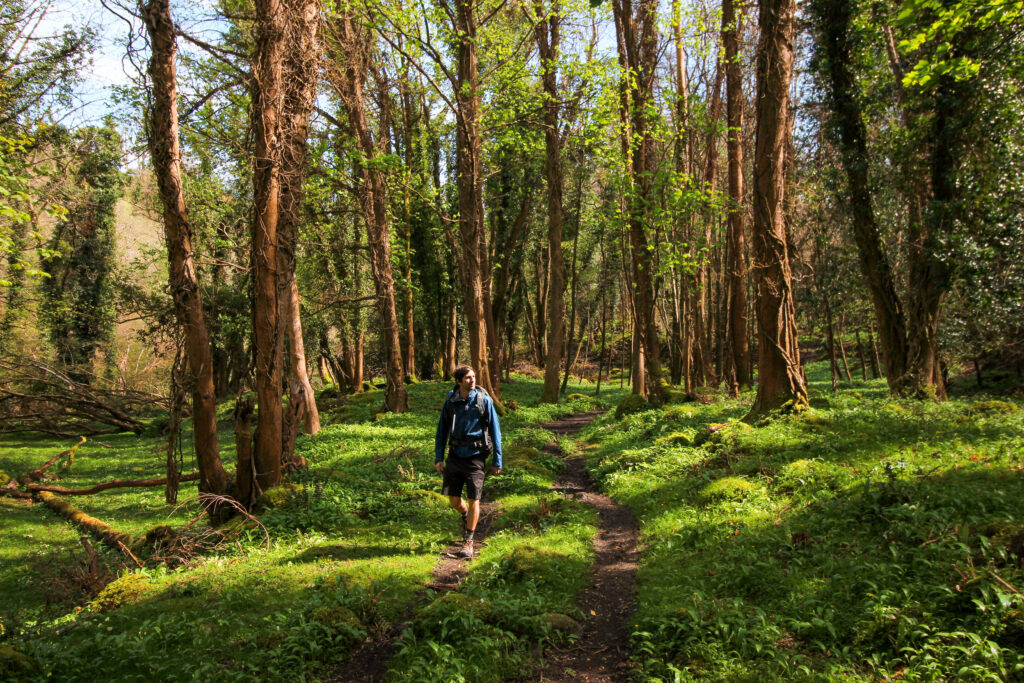
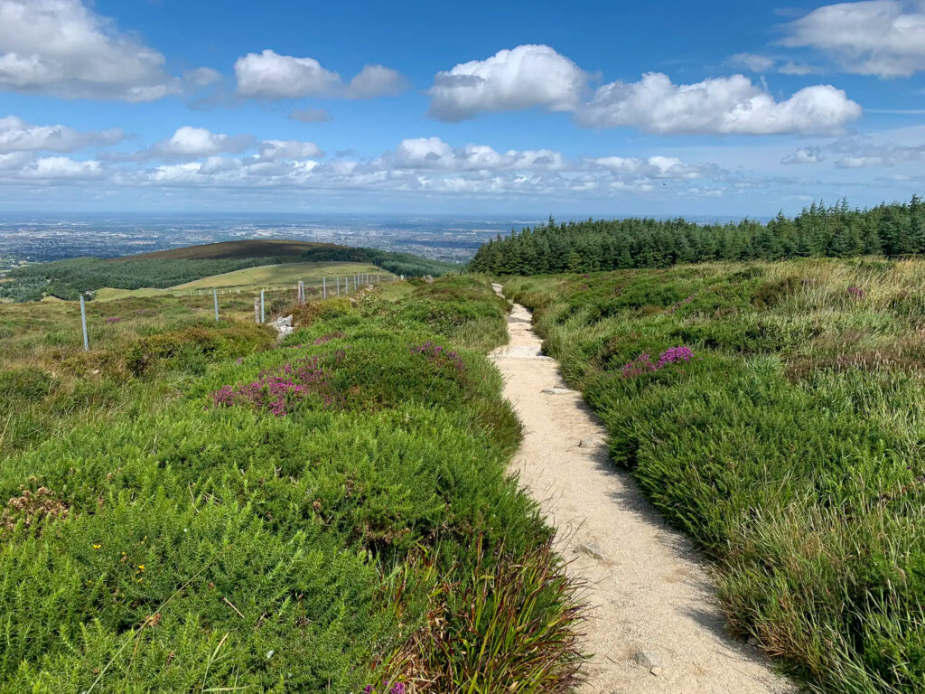
If you are looking for a longer day out in nature that ends up in a cute cafe, try the 17km route from Marlay Park to Enniskerry. The route begins following the official Wicklow Way route (which sadly does mean walking along a road for a bit), before you head onto a gravel path in the forest and hike up a rocky path to Two Rock Mountain (536m). From this summit, also known as Fairy Castle, you have very extensive views of Dublin to the north, the sea to the east, and the Wicklow Mountains to the south. From here, you head down (pretty steeply for a bit) into a forest with trails shared with mountain bikers. You’ll pass the Ballyedmonduff Megalithic Tomb.
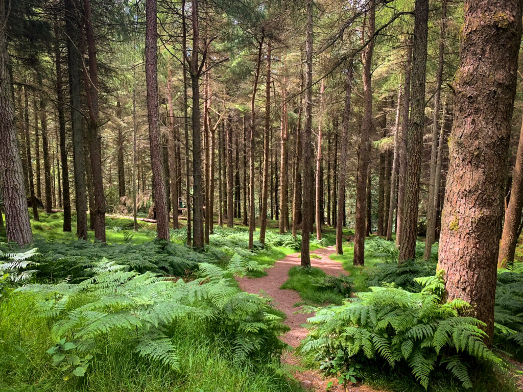
After a bit you walk past the GAP kitchen where you can stop for refreshments (and sweet treats) plus a bathroom break. After this point, you will need to walk along a road a bit before you reenter the woods and descend fairly steeply towards a creek. You’ll follow this moss-covered stream, walking through ferns and a pretty impressive coniferous forest, before you come out at Enniskerry. Here, I’d recommend stopping at Poppies for a coffee or tea before you make your way back into the city.
You can follow the full trail, step-by-step, here.
How to get there
You can take the 16 bus from Dublin city centre down towards Ballinteer and get off at the Marlay Park stop. The bus runs fairly frequently (about every 10 minutes). To come back from Enniskerry, you can get the 44 towards DCU. Do note that on weekends, the bus only departs once an hour, on the half hour. Alternatively, there’s a bus, 185, that runs to Bray, though this will cost €2.60 since it does not belong to the Dublin network. You can pay for both the 44 and 185 with your TFI Leap Card.
Marlay Park to Scholarstown via Tibradden Mountain and the Hellfire Club, 19km
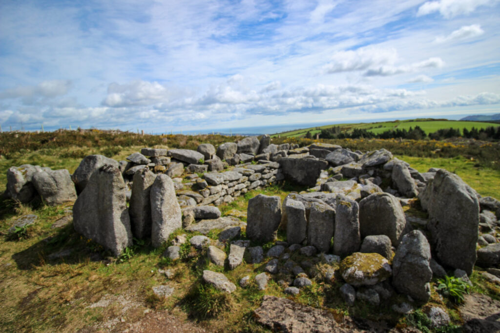
Like almost all hikes into the Dublin Mountains accessible by bus, this one too starts at Marlay Park. It passes through the open meadows in the Dublin Mountains before entering a pine forest. You’ll walk up Tibradden Mountain (467m high) where you can see a prehistoric burial cairn that possibly dates back to the Bronze Age. From here, you’ll reenter the forest where you’ll pass by a tree climbing area near Cruagh Woods. From Cruagh Woods, the trail heads into Massey Woods following a cute creek. It can be pretty muddy here. When you exit Massey Woods, you can either take a 2km detour to Hellfire Club (it’s a nice place to sit on a good day). Or you can walk along the road toward Bullycullen (take a left on Gunny Hill and beware of the vehicle traffic). If it’s still early, the Timbertrove Cafe is on the way and is open for food and drinks before 4:30pm.
You can follow the full trail, step-by-step, here.
How to get there
You can take the 16 bus from Dublin city centre down towards Ballinteer and get off at the Marlay Park stop. The bus runs fairly frequently (about every 10 minutes). To get back into the city, you can take the 15 bus from Ballycullen Road.
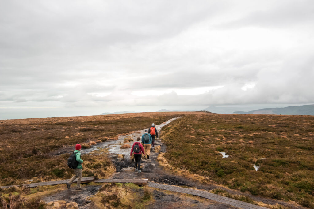
Scholarstown to Tallaght via Bohernabreena Reservoirs (point-to-point), 17km
If you’ve exhausted most of your other day walk options around Dublin, you can try this loop-like walk. The walk is a fairly easy, if not long, and doesn’t have too much ascent and descent. The walk does tend to be on paved roads a lot, so this might not appeal to people looking to get on traditional dirt trails. But that said, the roads are quiet country roads with little vehicle traffic. Plus if it’s been raining a lot but you really want to get into nature, this might not be a bad option for you.
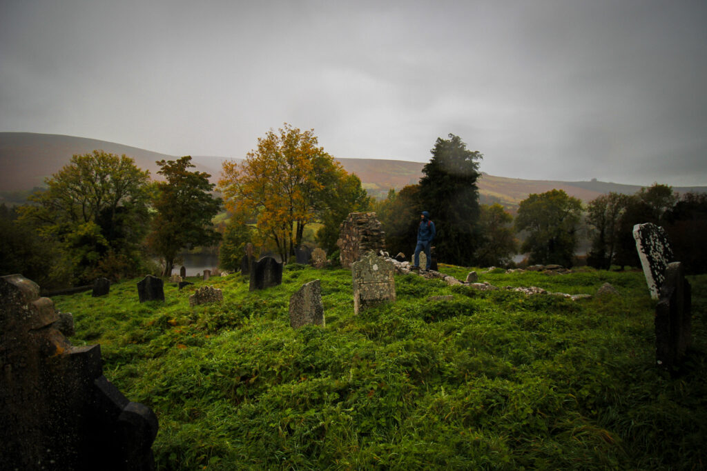
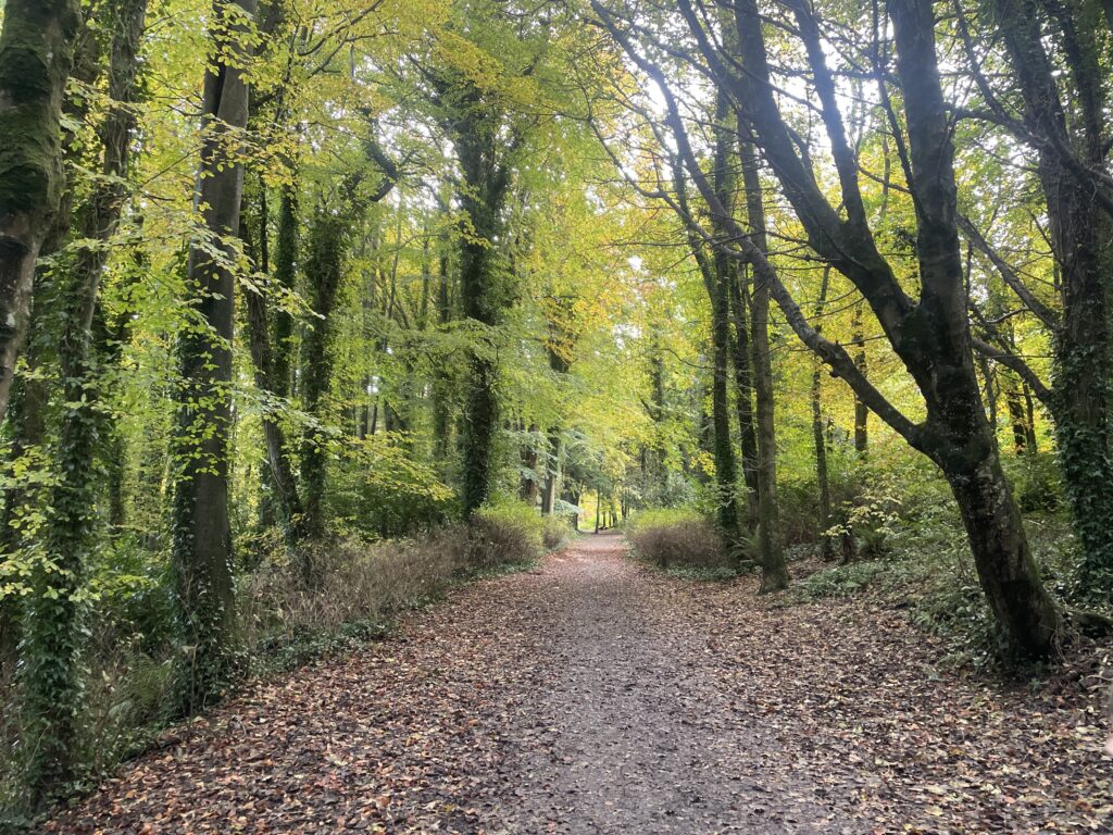
The hike starts off with 2km walking along a road, which is why it’s not exactly my favourite route (I prefer all trails). But once you’re off the road, the quality and experience rapidly improves. The trail winds through Massey Woods (which is gorgeous in the fall by the way with all the colourful leaves) and follows along pretty creek. At the T-junction with the road, you’ll follow along a road for a very short time before entering the Dublin Mountain Way trail. This leads you to a very quiet country road which was actually quite interesting to walk on if you don’t really get out into ‘rural Ireland’ much. At about 10km into your walk, you’ll take a right down a little gravel path towards an old cemetery (which we visited when we did this hike for Halloween). At the end of the cemetery, it’s a bit awkward – but you will have to hop over a gate where sheep are fenced into to join the footpath along the reservoir. The walk into Tallaght from here is quite easy – keep following along the reservoir which rejoins you with the Dublin Mountain Way and brings you into Tallaght.
You can follow the full trail, step-by-step, here.
How to get there
You can do this walk either starting in Scholarstown and finishing in Tallaght or vice versa. To get to the hike start in Scholarstown, take the 15 and get off at Bullycullen Road. From Tallaght, take the 49 or 65B from Kiltipper Road to head back into Dublin centre. You can pay for any of these buses with your TFI Leap Card (or cash if you don’t have the reusable green card).
General Hiking Tips
For more remote destinations, like Enniskerry, always check the bus schedule ahead of time because bus frequencies and operating hours can be limited. Have enough cash loaded on your TFI Leap Card (or otherwise, have the top-up app loaded on your phone).
When walking on roads between the trail sections, make sure to walk opposite the traffic. In Ireland, that means walking on the right-hand side.
Bring plenty of layers and rain gear – you never know when the weather will suddenly change. You can easily have all four seasons in a single day in Ireland. Also check the weather forecast for wind warnings – coastal walks or any peaks will be unpleasant if it is very windy.
Don’t forget Howth Head 🙂