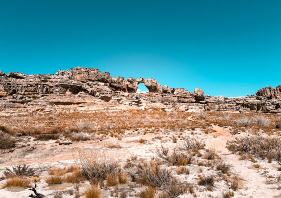
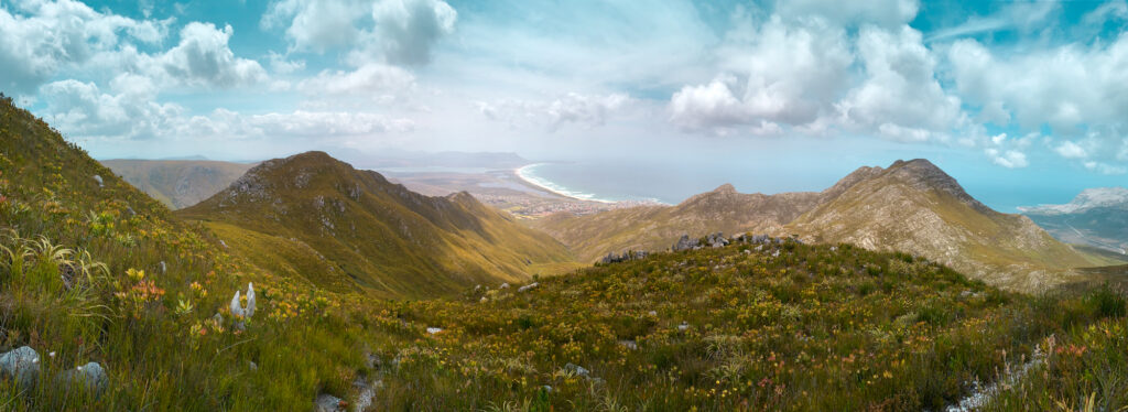
Accessible just an hour and a half outside of Cape Town, the 35km Highlands Trail is the ideal starter trail if you want to get a taste of an overnight multi-day hike. Since we were keen on doing the 3 to 4 day Congo Nile Trail hike in Rwanda but had never done a multi-day hike before, we wanted a better idea of what hiking with packs and sleeping in rougher conditions would be like. That said, maybe try the Highlands Trail after you’ve done a few 8-hour hikes first. Even if you’ve done multi-day hikes before, this is still a pretty epic way to spend your weekend.
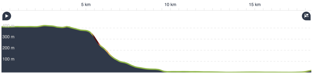
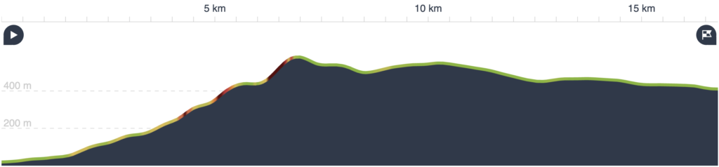
On the whole the elevation gains and losses aren’t major across the two days. However, because of the long distances, this hike can feel moderate to difficult depending on your fitness level. If you want more extreme elevation, rather check out the Arangieskop overnight hike.
You’ll need permits to do this hike which you can get for up to 12 people from CapeNature (+27 87 087 8250). Permits are 120 ZAR per person, but are waived if you have a Wild Card.
Day 1: Iona Farm to Kleinmond via Bot Rivier Vlei
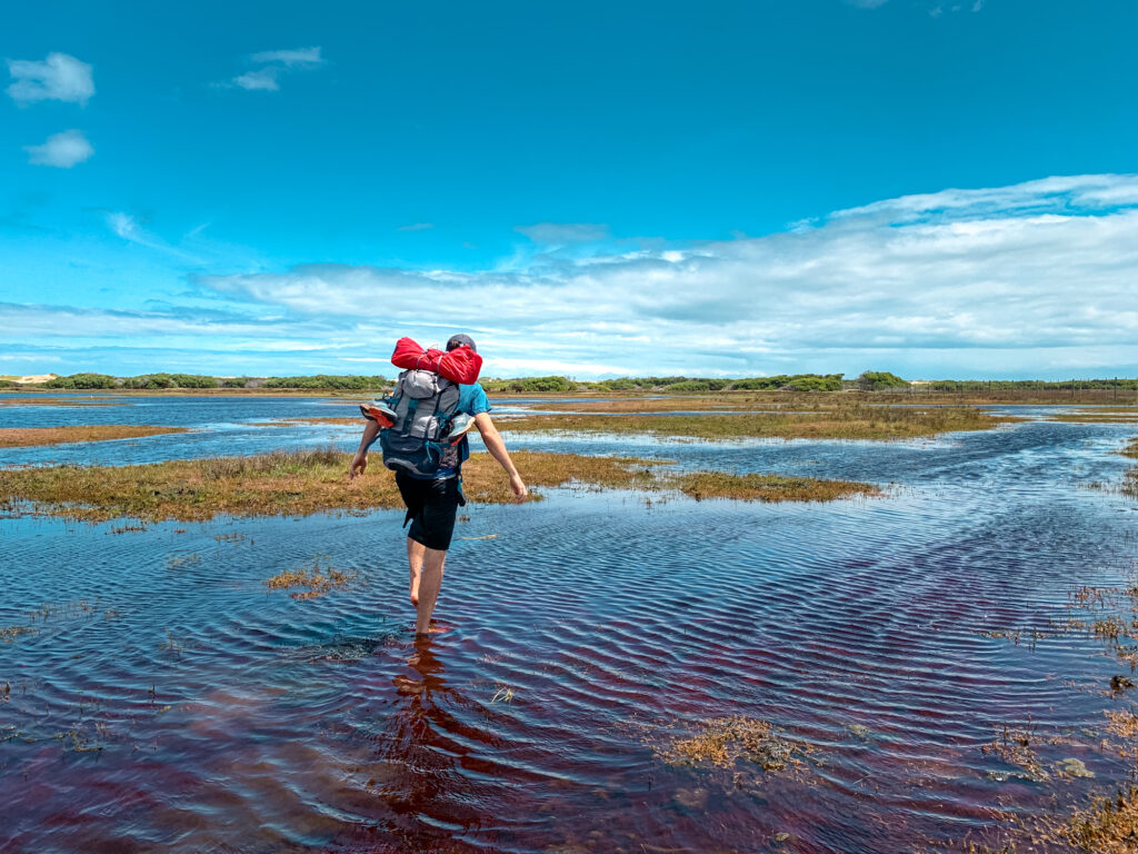
Prepare to get your feet wet today because you will walk from Iona Farm to Kleinmond, literally, via Bot Rivier Vlei. I mean literally. You will be walking through the lagoon. If you’re lucky the tide will be in your favour. If you’re unlucky, hopefully you can hoist your bag above your head.
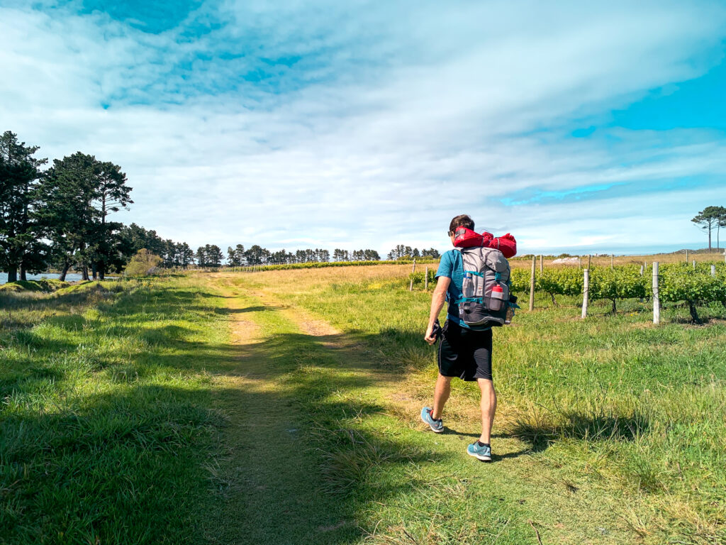
On Day 1, you can either have spent the night before nearby in Elgin or arrive from Cape Town in the morning. We set off at 9am. You can park your car just down the dirt road opposite Iona Farms (-34.281041278684995, 19.082352082047436). Nothing happened to our car while we were away. But you know, it’s South Africa. Hide your stuff. Take your valuables with. Enjoy the hike and worry when you get back.
Now you are going to set off in the direction of the dam. The hiking instructions CapeNature gives you when your booking is confirmed are completely useless. They say the trail is well-marked with footprints to indicate the way. You can try following them. You might probably get lost. Or you can follow someone else’s GPX track on an app. Like ours.
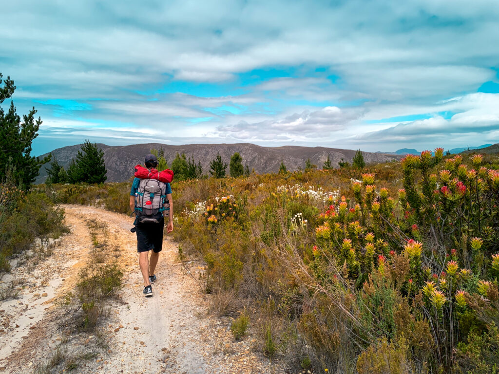
Essentially the day’s hiking breaks down like this. From the dam, you come to a jeep track (watch out for snakes, we encountered a rather cheeky puff adder who took up the whole path). You’ll enter a thickly grown area full of fynbos and pine trees. You’ll have glimpses of epic views out to the ocean, and then you will descend the mountain crossing a few streams if it has rained.
At the bottom you’ll cross the R44 by a gate and continue directly onwards by the other side. This area felt a bit weird. It’s flat and it doesn’t feel like you’re in the right place – but you probably are. You’re heading towards the vlei. You’ll want to aim for the Rooisand parking area (once again watch out for snakes – the local snake catcher just released a boomslang there when we came through and divulged that it’s his regular release spot).
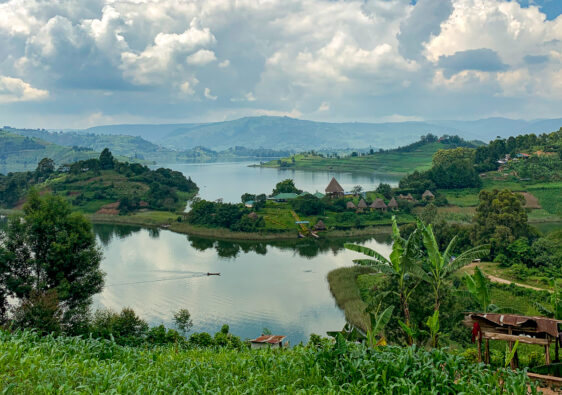
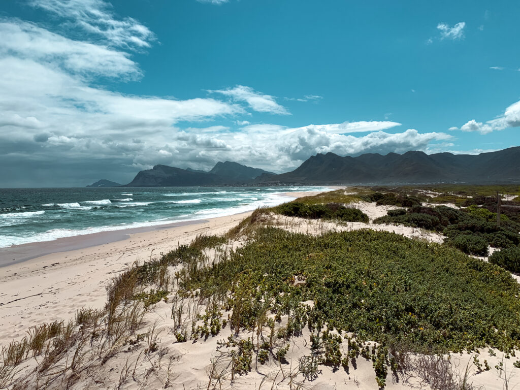
After walking along the boardwalk and past the bird hide, you’ll notice there’s no trail. That’s because you’re now going to walk straight through the water to the sandy other side to get to the beach. We walked close to the fencing to find the shallowest bits. It was rather disgusting – I find crossing lagoons disagreeable. Wild horses live in the area. Just keep your distance and they’ll keep theirs.
The last 3km are along the beach. It’s not as romantic as it sounds. Sand-walking is like the cruelest form of resistance training. That with heavy packs and strong winds makes for a tiring end to Day 1. But once you make it, you can finally cross the R44 to the Kleinmond Caravan Park campsite and relax for the evening.
We ended up walking another 2.5km to get fish and chips at the Ocean Fisheries. It’s on the edge of a township, but it was totally fine. And besides after hiking all day, their fish and chips are the best thing in the world. You can stop by SuperSpar on your way back to the campsite if you want some chocolate or need to stock up supplies for Day 2.
Fun Stats of Day 1: To Kleinmond Caravan Park
- Total distance: 18 km
- Elevation gain: 40 m
- Elevation loss: 440 m
- Expected hiking time (assuming good fitness, no breaks): 4:30 hrs
Day 2: Kleinmond to Iona Farm via Perdeberg, 21km
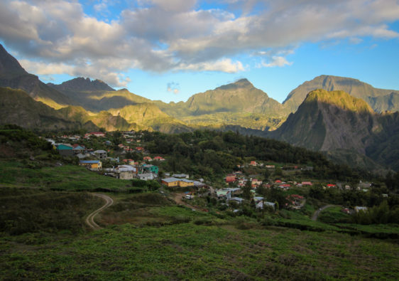
Because Day 2 essentially starts off by taking you along the backside of Kleinmond, you could choose to stay at Palmiet Caravan Park without adding extra miles to your hike. If you spend the night at Kleinmond Caravan Park, then you’ll walk parallel to the mountains on Geelhout Street, then turn right up Swartrivier Street to access the Kleinmond Golf Club by the mountains. You’ll find the trail in the far left-hand corner of the parking area.
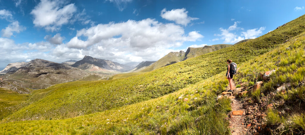
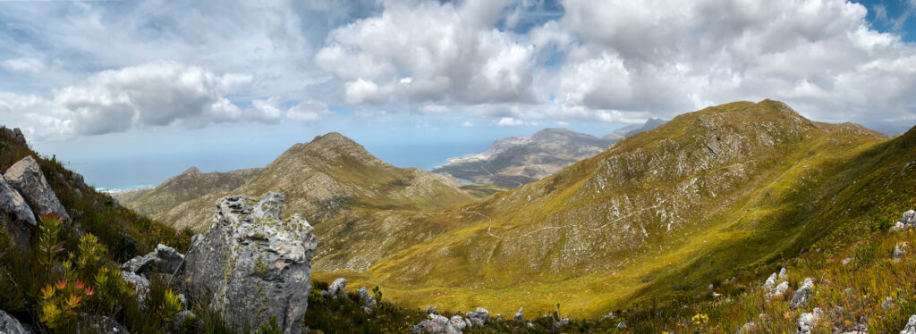
At the next stage we got lost. There’s a crossroads of trails, but you need to take the one towards the contour path that goes west around the back of Kleinmond. Not the one that goes straight to the Three Sisters and Perdeberg. (Though to be honest, you can get to Perdeberg and back to the Highlands Trail via the Three Sisters, but just be prepared for a much steeper ascent.) The contour path takes you around Three Sisters peak with views of Kleinmond and the Palmiet river to your left. Once again, watch out for critters. I almost stepped on a scorpion and puff adder on Day 2.
From the overlook of the Palmiet river and the Kogelberg Nature Reserve, you’ll start gaining elevation as you climb towards Perdeberg and come to a saddle. Here you go left and climb steeply up Perdeberg. If you want you can walk all the way up to the summit. Up to you.
Unfortunately, after Perdeberg things got a bit boring. You’ve got a long way ahead of you back to Iona Farm along a crumbly jeep track with absolutely no shade from the blistering sun. It’s straight and it’s long. I didn’t take any photos of it. There’s no where really to take a break except directly on the jeep track itself. The very last stretch of the hike brings you back along the road to where you parked your car.
Fun Stats of Day 2: Back to Iona Farm
- Total distance: 17 km
- Elevation gain: 630 m
- Elevation loss: 240 m
- Expected hiking time (assuming good fitness, no breaks): 4:30 hrs
Accommodation Options
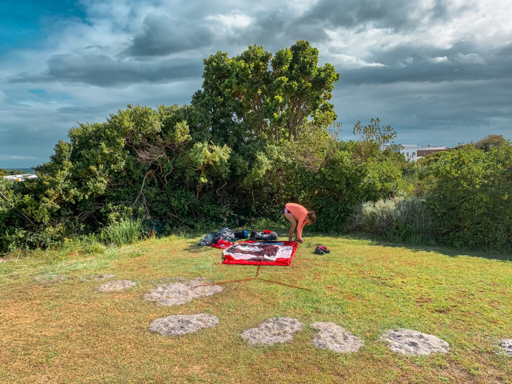
Day 1’s hike officially ends at the Kleinmond Caravan Park on the east side of Kleinmond. If you’re in a group you can book the Frank Robb Hut. It costs 90 ZAR per person and can accommodate up to 10 people. Otherwise you can do what we did and set up a tent. I’m not sure what that cost (maybe 90 ZAR?) since the card machine didn’t work and the receptionist waived us through. Had we had more energy, I would have preferred to camp over in the Palmiet Caravan Park because they have sites right by the ocean. Alternatively, if you don’t want to entirely ditch comfort, you can check in to one of the many B&B’s in town.
Packing Essentials
If you plan to camp, bring along enough for the night. You can read more about my camping packing tips. Download the Komoot app so you can find your way on Day 1 and Day 2. Since we were training for a longer hike, we purposefully made ourselves miserable and stuffed our bags with heavy camping stuff. But you don’t need to do that to yourself.
If you don’t camp, then you won’t need much other than snacks, some meals, and 2L of water per day. There is no potable water on the way on either day, but you can refill before you set off Day 2. Bring sunglasses, a hat, and sunscreen to protect yourself from the UV rays. Other than that, that’s about everything you’ll need. Happy hiking!