Most people coming to Ireland, either come to see Temple Bar in Dublin or the Cliffs of Moher. But if you want to see the famous landscapes that the Irish fairytales are all about, then you should go to Kerry.
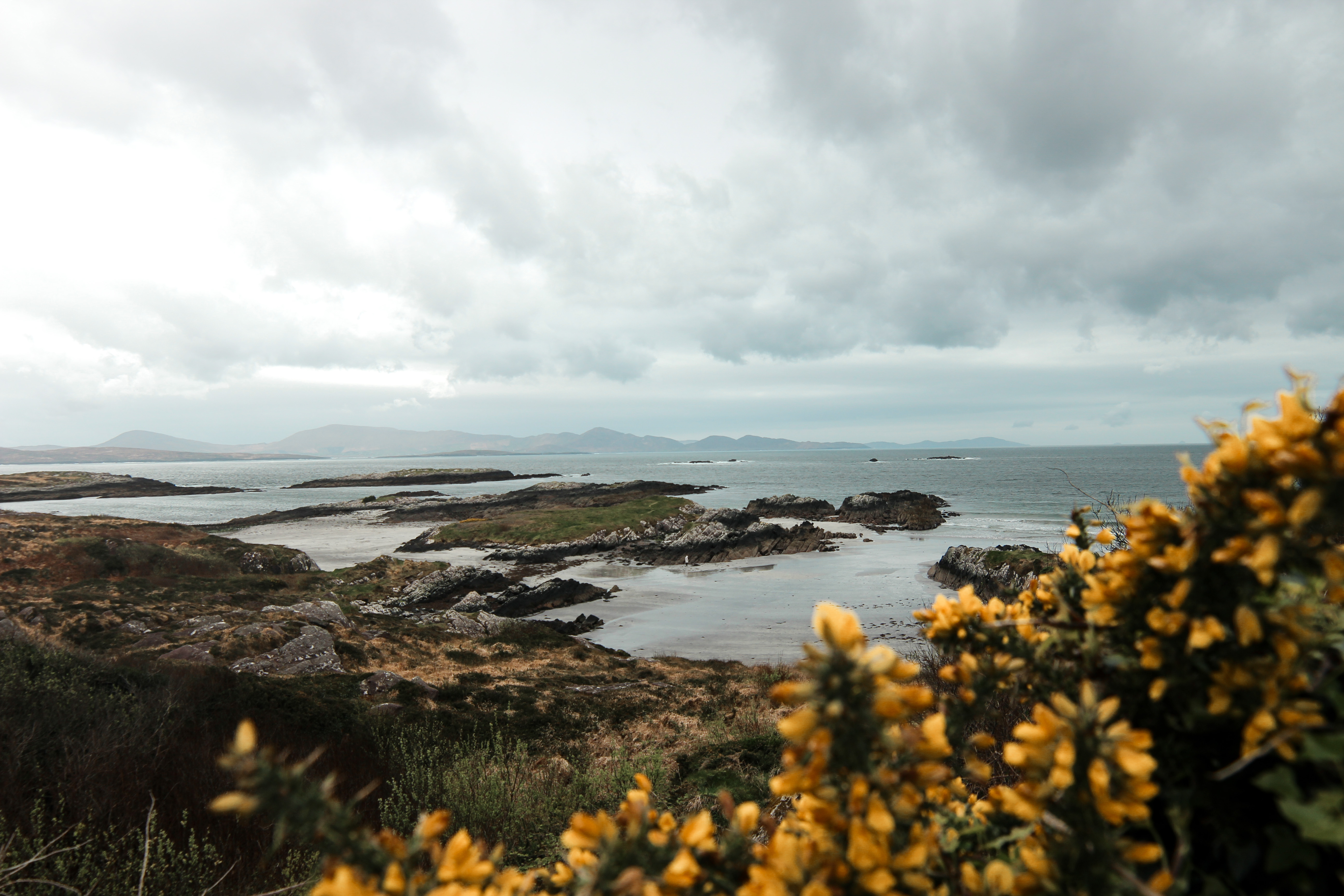
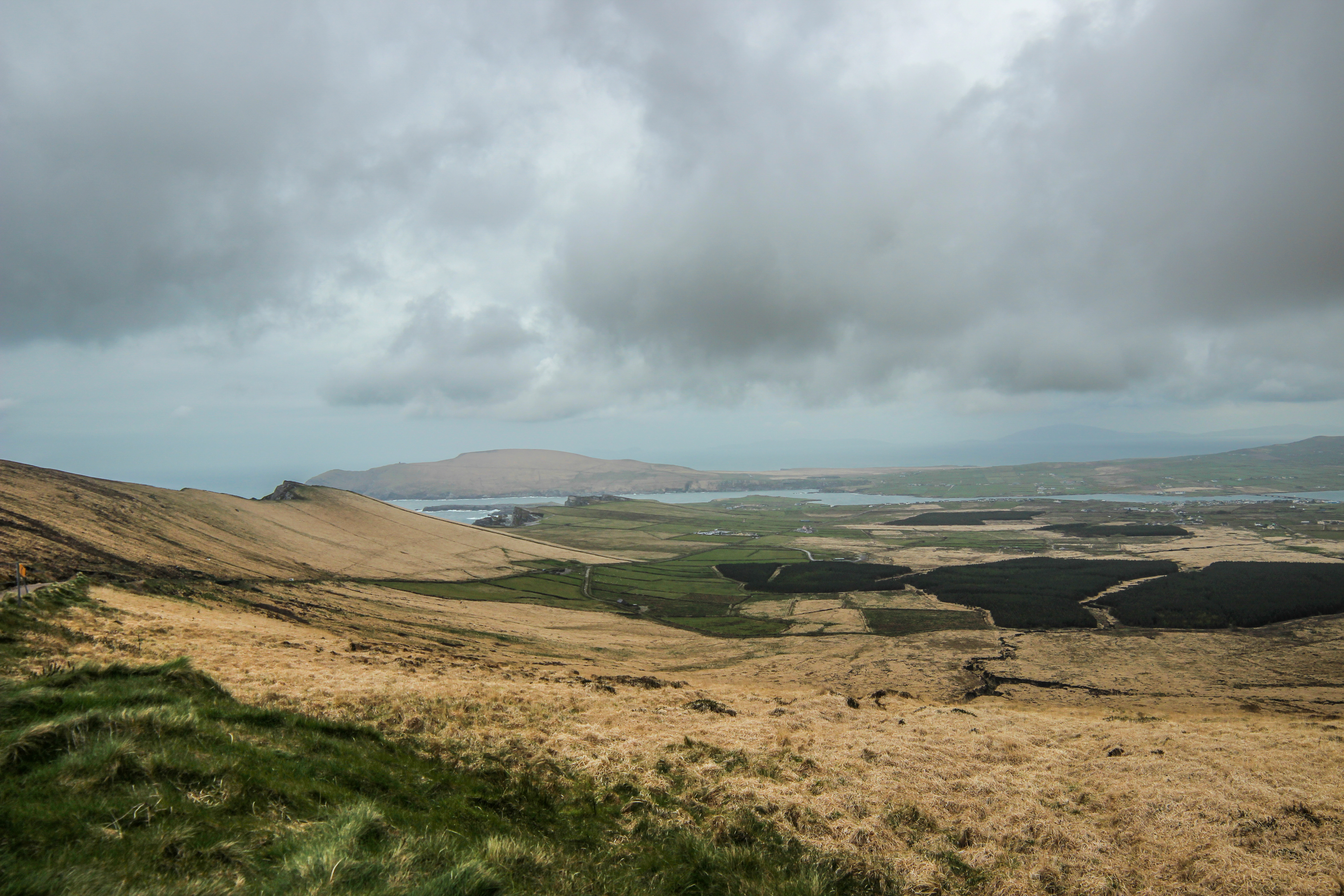
The Ring of Kerry is a popular route that is best experienced by bicycle so that you can take the time to enjoy the stunning scenery. The route passes through mountain valleys, along coastlines with views of picturesque islands, and remote farmland.
What is the Ring of Kerry cycle route?
While there’s an official charity cycle event that follows the N70 Ring of Kerry road for 170km, there are only unofficial routes for doing this tour outside of the official event. During the official event, the road is closed off to cyclists only. On any other day, it’s a pretty popular road with cars and buses, which means as a cyclist you want to try to avoid it. Plus it doesn’t have the nicest views.
You can find think link to the maps to follow along the cycle route here:
Ring of Kerry Cycle Route Maps
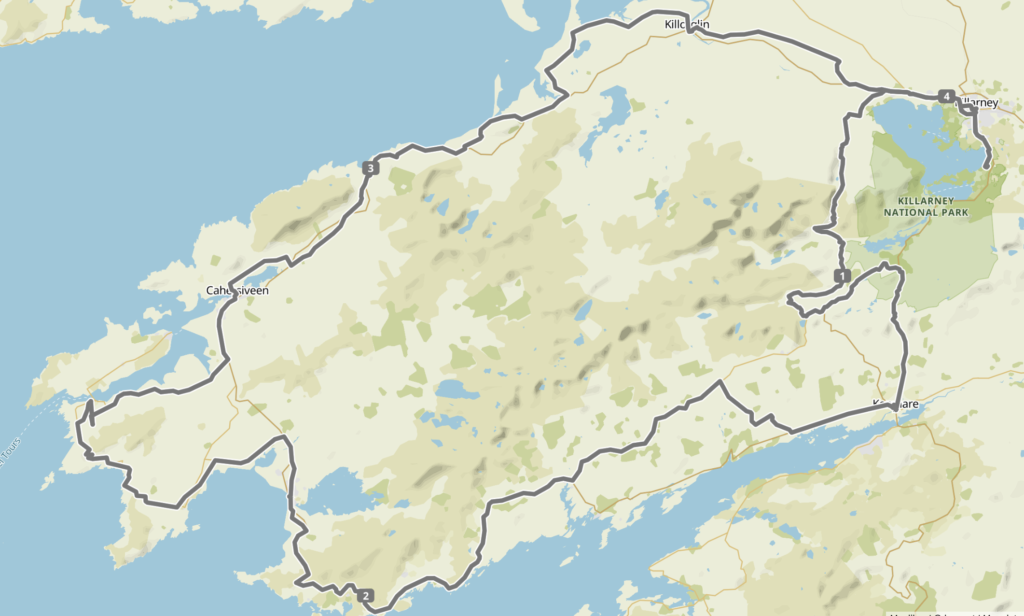
There are variations of the route you can follow in the link as well. I describe these variations in more detail below so you can decide what route works best for you.
How many days do I need to cycle the Ring of Kerry?
If you’re a regular Tour de France competitor, you can do it in a day. If you’re a normal person who wants to see things along the way, you should plan to cycle the Ring of Kerry in 3 to 6 days. We did split it over the four day Easter weekend which worked out well. Though we could have easily combined days 3 and 4 since the route was fairly flat both days.
Not sure how many days you need? Test out a 60km route with some hills and see how you feel afterwards.
When should I cycle the Ring of Kerry?
While the chance of rain is always there, your best bet is to visit from April to September when the days are warmer and the rainfall is lighter. Longer days also allow you to cycle when there are dry spells without needing to worry about nightfall.
Which direction should I cycle the Ring of Kerry?
Since you’ll be periodically cycling on the well-driven Ring of Kerry road (the N70), you’ll want to minimise your exposure to heavy bus traffic. The best way to do this is to cycle clockwise (the tour buses drive counter clockwise).
What do I need to pack for the Ring of Kerry cycle trip?
Rain gear. It rains a lot in County Kerry. In fact, the record rainfall for Ireland was recorded in Kerry. Even if it says sun, expect some showers. If it says rain, expect some sun. The clouds come and go. Otherwise, you’ll want to make sure you have layers so you can dress as you go. The weather is unpredictable, so be prepared for anything.
Where can I rent bikes to cycle the Ring of Kerry?
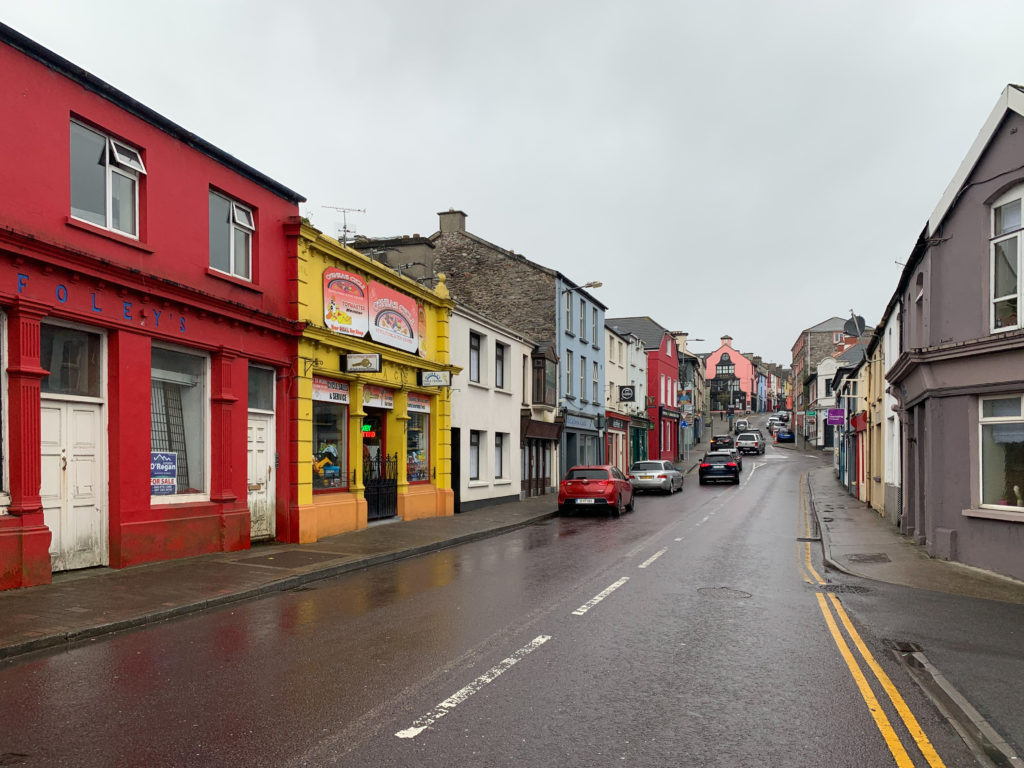
You can rent bikes directly in Killarney if you don’t have your own bicycle. We rented our bikes from O’Sullivans Killarney Rent a Bike. Their touring bikes cost €20 a day and come with free rear panniers (so you can stash your stuff in there), helmets, locks, and basic bike repair tools like a pump and spare tire tubes. These were pretty good quality bikes with shock suspension, disc brakes and 24 gears. They also have e-bikes for €45 a day.
How do I get to Kerry?
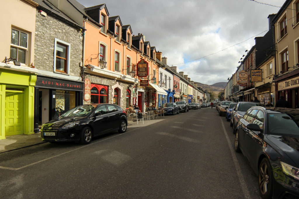
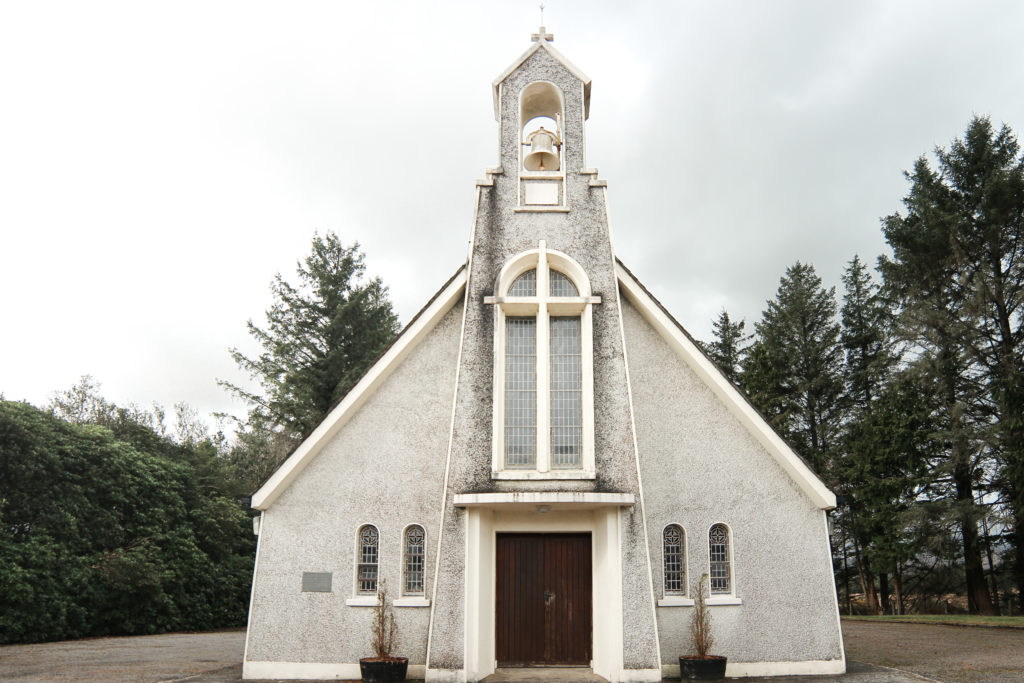
The cycle route begins from Killarney, a cute town at a lakeside overlooking the mountainous Killarney National Park.
You can either drive, take the train or fly to Killarney in County Kerry. Flights (RyanAir) from Dublin take about 40 minutes (but don’t forget to factor in the time getting to the airport). Driving takes 4 hours from Dublin. The train is the best way to get here – it only takes about 3 hours, making it the shortest journey from end to end (and one of the cheapest). You can book your train tickets here.
How much should I budget for my Ring of Kerry Cycle trip?
Depending on your travel style and needs, the cost of the trip will vary. If you choose to stay in hotels, budget around €100 a night. Most places include a hearty breakfast which helps. Obviously, if you are cycling during summer and can camp, that will bring down the cost to roughly €20 per night.
Dinner for two at a pub with drinks is about €40. There aren’t many supermarkets along the way, so your food options can be limited. We brought granola bars and nut mix with us to snack on during the day. Since it was cold and wet, we often also broke up the rides with a cafe stop. Cake and coffee/tea for two was about €15.
If you need to rent a bike, a trekking bike (not electric) is about €30 per day.
For two people for the four day trip, with two rental bikes, four nights accommodation (3/4 stars) dinner each night and coffee and tea stops along the way to warm up, we spent around €900.
Day 1 – Killarney to Kenmare
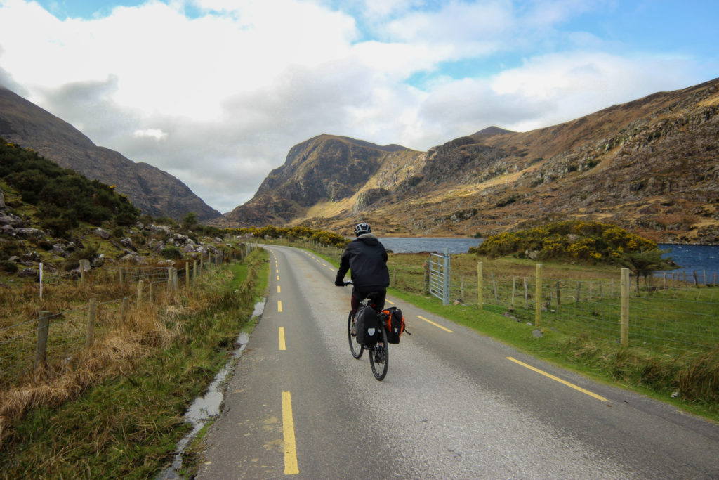
You’ve got two route options from Killarney to Kenmare: the shorter, flatter route or the more dramatic, mountainous route. Both are scenic, but the mountainous route is more remote and arguably more rewarding. If you choose to do the mountain route through the Gap of Dunloe, remember – you can always push your bike if you need to.
If it’s a windy, cloudy day, I would avoid the route through the Gap of Dunloe because you will have 5km of severe headwinds while trying to cycle uphill. It’s not pleasant. Rather stick to the more direct route from Killarney along the lakes to Kenmare via Ladies View and Moll’s Gap.
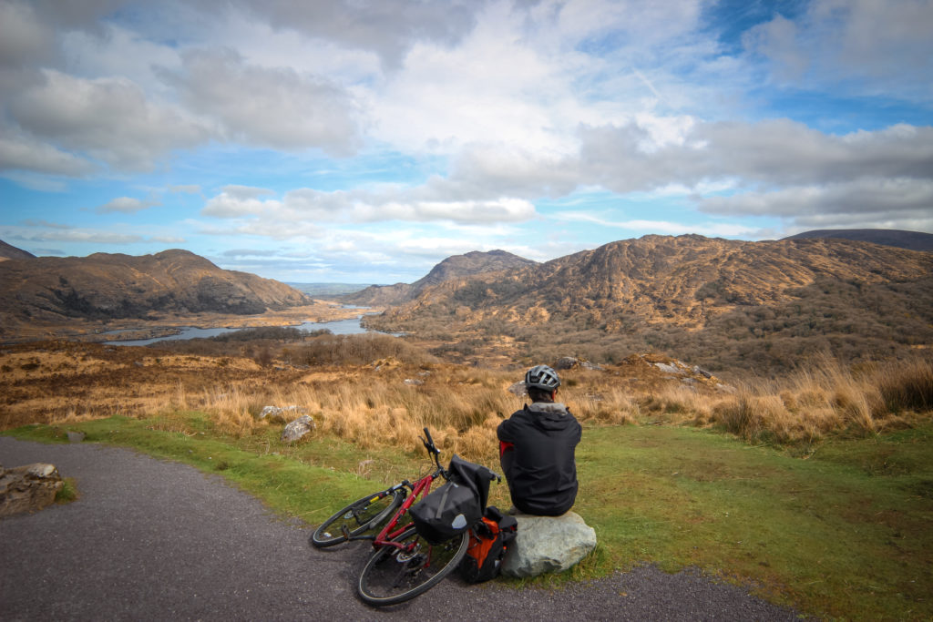
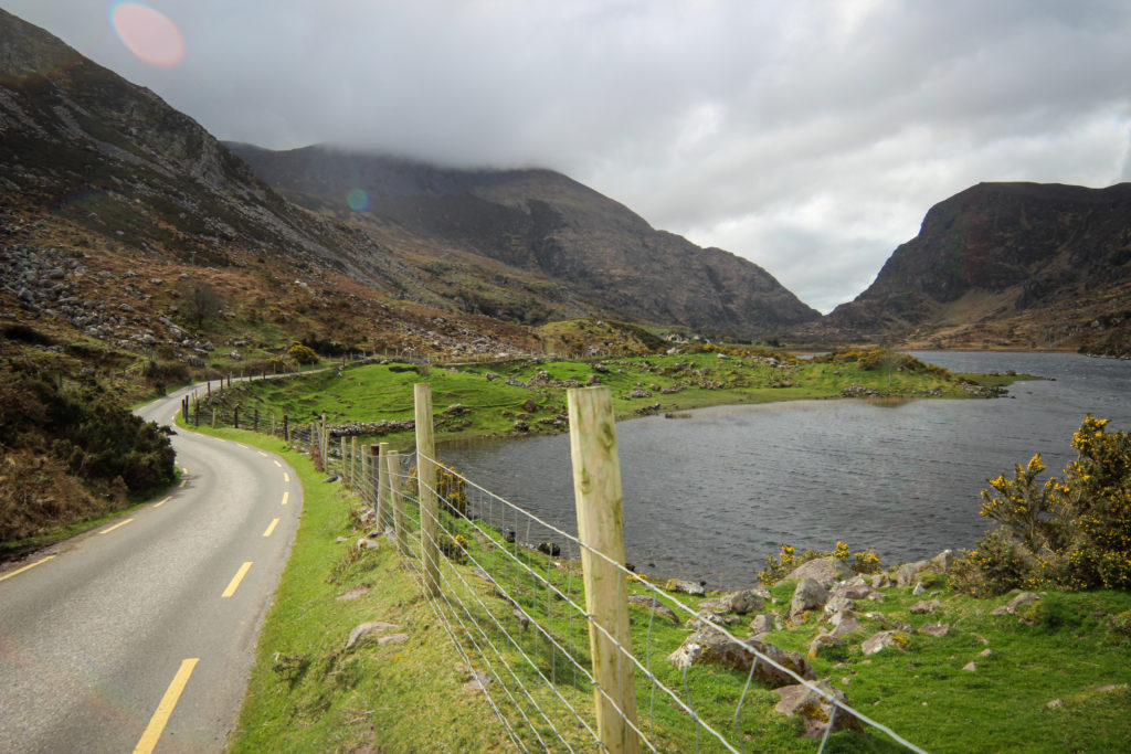
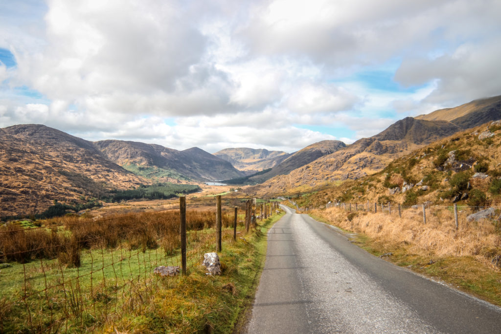
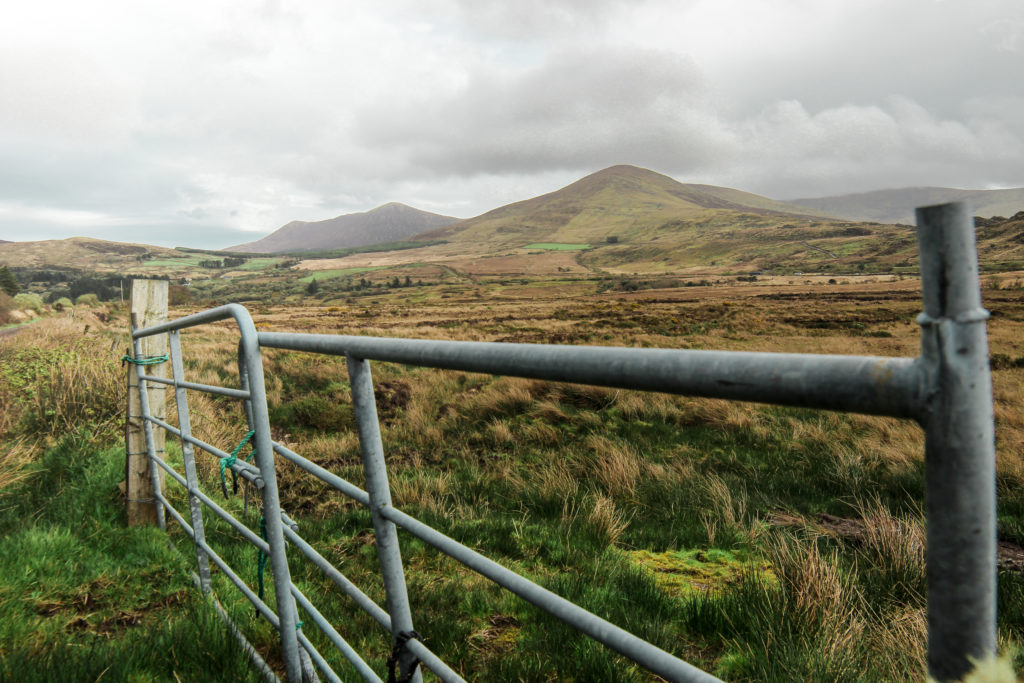
We did the mountainous route but I wouldn’t advise on following our exact route. There’s a corrected version for you to follow in the route map link. We chose to head to Kenmare via the Gap of Dunloe and the Black Valley. This added considerable elevation, but was one of the more stunning parts of the trip. The Gap of Dunloe is a valley with small lakes that looks like it came straight out of a Turner painting. The Black Valley is a remote valley, dotted with a few farms, and a quiet farm road that winds along a river and valley before it steeply climbs up to Moll’s Gap.
At the top of Moll’s Gap we should have followed the road through 10km to Kenmare but we mistakenly went to Ladies View first and then down the hill towards what we thought was a gravel cycle path. Turned out it was about a 5km hiking route through a valley and up a mountain. Without mountain bikes, it wasn’t great. Though it was extremely scenic so you could go this way if you are okay with walking your bike for a bit.
Fun Stats of Day 1: Killarney to Kenmare
- Total distance: 33 to 54 km, depending on the route variation
- Elevation gain: 390 to 800m, depending on the route variation
- Expected cycling time (@13kph): 2.5 to 4hrs
Day 2 – Kenmare to Portmagee
This day is extremely long and very hilly. We only planned it this way because we couldn’t find accommodation anywhere earlier along the route. Ideally otherwise I wouldn’t have cycled more than 60km a day because of the unpredictability of the weather.
Alternatively, to shorten the cycle route, you can skip the Skellig Peninsula area and go from Waterville through to Cahersiveen. Though, then you’d miss the views of the famous islands Luke Skywalker lives on in Stars Wars. Plus Portmagee has very good fish and chips you wouldn’t want to miss out on.
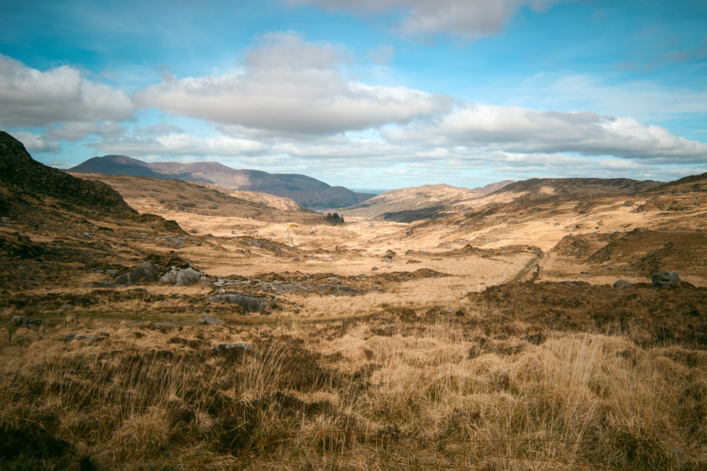
The day starts off following the N70 out of Kenmare for a short distance before you split off to the right on a small farm road leading up the hillside. The elevation gradient is mild so it’s not too bad on the legs, but it’s nice to get so height so you can see views of the water.
You’ll connect to the R568 where you have two options for the day that both reconnect at Waterville: either to follow the coastal route or head inland through the mountains. The inland route is probably nicer, but where you go will come down to the weather.
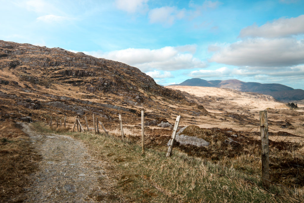
Because of the windy, rainy weather, we chose to avoid the mountains, where the clouds were gathered, and stick to the coast. If you choose the mountain route, you’ll follow the Eurovelo 1 route from R568 to the right up Ballaghbeama Gap road and then turn south towards Ballaghasheen Pass and Waterville. It’s got more elevation, but far less cars and more mountain views.
We went along the R568 until we connected up at Sneem (they’ve got cafes and public restrooms) and then followed the N70 along the coast. It became much more scenic when we got past Caherdaniel and began our ascent up the mountain pass towards Waterville.
From Waterville, the route follows a mostly flat road (along the official Eurovelo 1 route) until you get to Keel where you should absolutely pause for a few chocolate tasting at Skelligs Chocolate. They do not hold back on the sample sizes. Plus, the worst hill of the entire bike route is ahead of you and you’ll want the energy to push your bike up the steep 240m hill. This hill is also the highest point you can drive by car in Ireland, apparently.
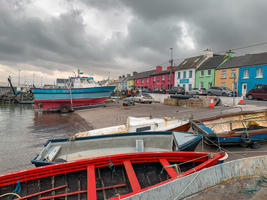
Portmagee itself is a small fishing village with a very local vibe and very good seafood at the Fisherman’s Bar & Skellig Restaurant. Nearby are also the Kerry Cliffs which you can visit for €5. If you’re visiting during the months of mid-May to September, you can also pre-book a boat tour to either come near the Skellig islands or even land on them to visit the ancient monastery (that scene from Star Wars). If you choose to do this, you’ll need to pre-book well in advance and be ready for your trip to get cancelled with the weather.
Fun Stats of Day 2: Kenmare to Portmagee
- Total distance: 90 km
- Elevation gain: 1190 to 1270m, depending on the route variation
- Expected cycling time (@12kph): 7hrs
Day 3 – Portmagee to Killorglin
Depending on your appetite, you can either begin your cycle route via Valentia Island following the official Eurovelo 1 route to the ferry crossing (€2 euro for a cyclist) or simply follow the R565 to Cahersiveen.
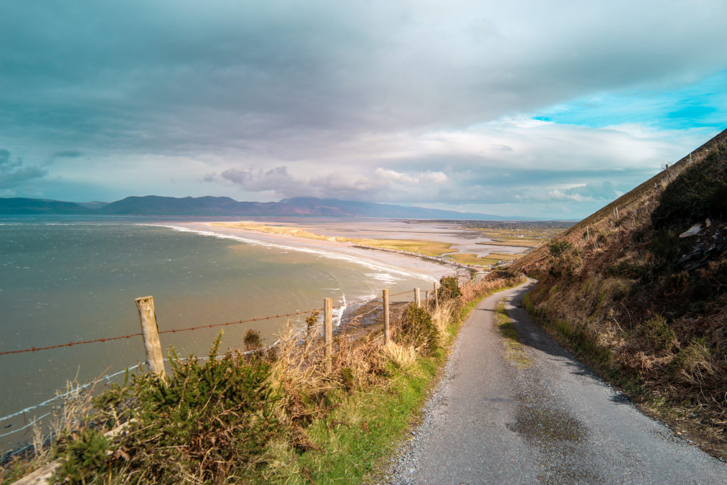
From Cahersiveen it’s a fairly flat cycle, sometimes along the N70, but more often along quiet side roads, until Rossbeigh. If you veer left around the mountain rather than right along the Eurovelo 1, you’ll be rewarded with a stunning view of the Rossbeigh Strand, teal blue ocean and the mountains of Dingle Peninsula across from you. Down at Rossbeigh Strand (the beach) there are public restrooms you can use.
From here, you’ll follow the N70 for a short bit before you turn off to a quiet road that follows the coast line with dramatic views of the mountains until you get into Killorglin.
Fun Stats of Day 3: Portmagee to Killorglin
- Total distance: 64 km
- Elevation gain: 520m
- Expected cycling time (@13kph): 4.5hrs
Day 4 – Killorglin to Killarney
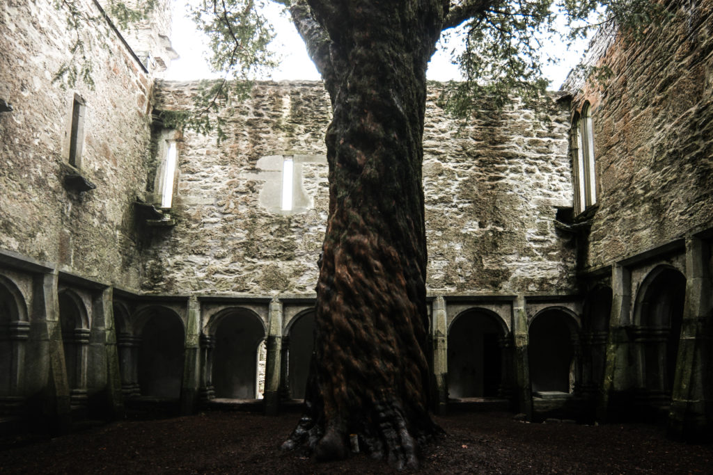
This is the shortest day of them all and by far the flattest. We chose to extend it somewhat so we could go visit the Muckross Abbey ruins in the Killarney National Park to the west of Killarney. If you have time and the weather holds, I’d highly recommend you do the same. Again, the trip today only is on the N70 for a few kilometres and mainly follows farm roads and a cycling path.
Fun Stats of Day 4: Killorglin to Killarney
- Total distance: 30 km (or only 22km if you do not go to Muckross Abbey)
- Elevation gain: 160m
- Expected cycling time (@13kph): 2.5hrs