I wouldn’t normally recommend visiting a large chunk of a country in only a few days, but in Iceland’s case, staying any longer can put you into serious debt. I designed this leg of the trip to fit into three days, but if you are short on cash or time, you can terminate your journey early (at Vik, for example) or skip on Day 3’s activities around the peninsula south of Reykjavik. For general tips on budget-travel in Iceland, check out my other post to read more about how to be prepared for Iceland.
Starting off in Reykjavik
Reykjavik is the capital of Iceland, and home to the majority of Iceland’s roughly 350,000 thousand citizens. It’s quite small, so you can budget a day or half a day here depending on your flexibility. In any case, it is a great starting point for visiting the Golden Circle or for setting off eastwards along the southern coast of Iceland. If you arrived here by rental car, be aware that most streets have parking fees from 9:00-18:00.
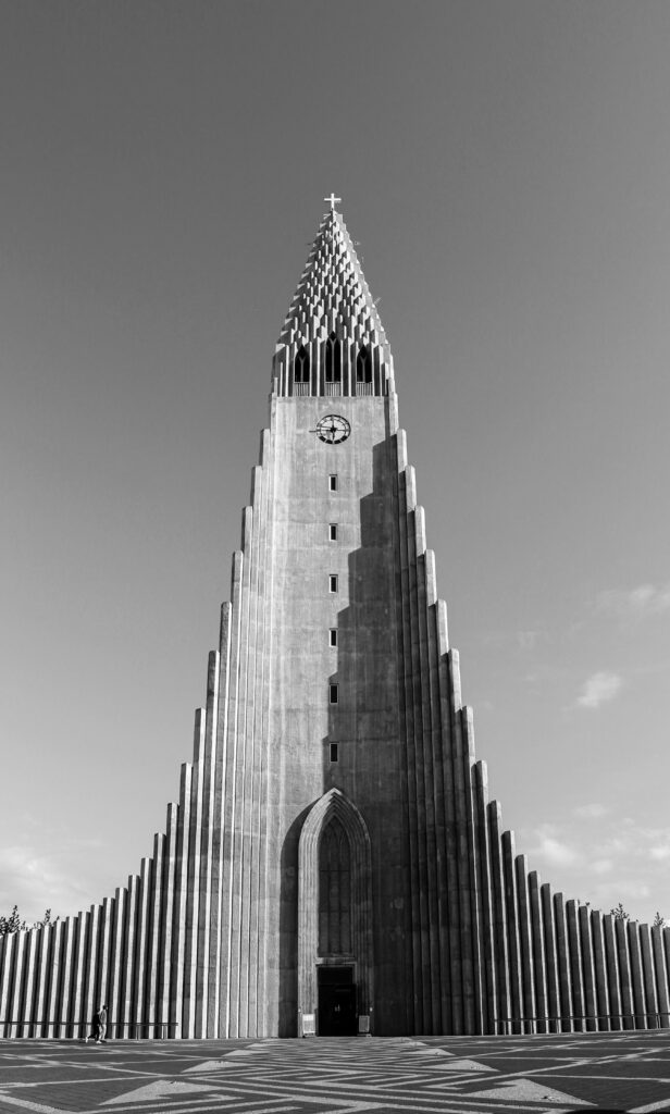
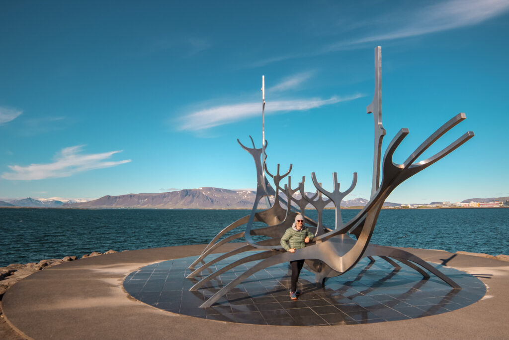
In the city, check out the Harpa concert hall and conference centre. The coloured glass facade was inspired by the basalt landscape of Iceland, as was the design of the nearby famous church, Hallgrimskirkja. From the Sun Voyager sculpture, there are beautiful views of the sea and the nearby mountains. The Tjörnin, or pond, separates the city centre from the east and west neighbourhoods and makes for a nice stroll on sunny days. The inner city streets are quite cute to walk around, if not a bit over-inundated with souvenir shops.
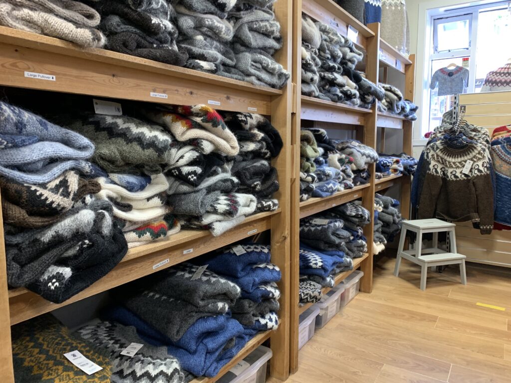
The Handknitting Association of Iceland is one of the few places that you can get real lopapeysa for under 300 USD. To be genuine lopapeysa, the wool needs to come from the Icelandic sheep and be knitted in Iceland. Most of the sweaters you’ll find in the souvenir shops are made from Icelandic sheep wool, but are knitted abroad, and therefore not true lopapeysa.
On the Ring Road: from Reykjavik to Höfn
After completing the Golden Circle tour, we decided we wanted to make Höfn our furthest destination east and then loop back to Keflavik airport from there over the next three days. We had a handful of top sites we wanted to visited and mini-hikes we wanted to try out, and planned to visit them depending on how the weather went on the day out and day back from Höfn. Since the weather can be tricky in Iceland, if you want clear skies for your photos, it doesn’t hurt to plan this way so that if on Day 1 the weather doesn’t work out, on Day 2 you can work in the stop for the photo spot. On the rainy days, you can do the activities that didn’t need good weather, like visiting the Sólheimasandur Plane Wreck.
Day 1 on the Ring Road to Höfn
Since we did the Golden Circle tour from Reykjavik, we spent our first night some distance in on the Ring Road. If you’re coming direct from Reykjavik, you might want to spend your first night in Vik rather.
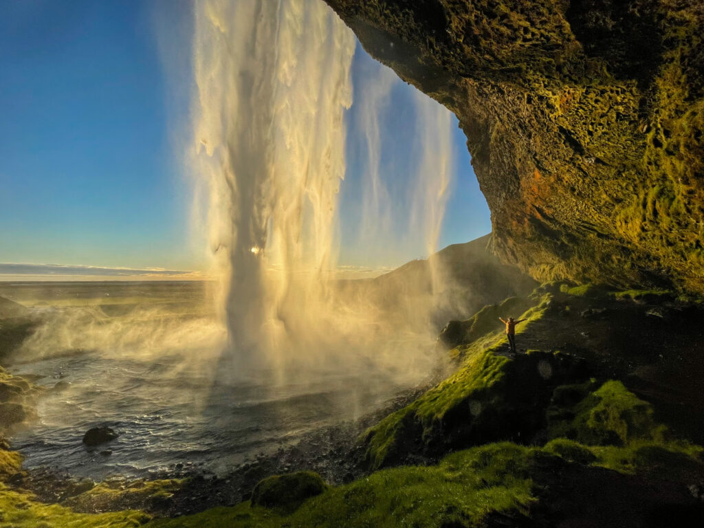
We spent our first night on this leg of the tour at Paradise Cave Hostel (which despite the name was much more expensive than any hostel I’ve ever stayed at – quite a few older couples were here). The advantage of staying at this point was that we were able to check-in and then easily visit the popular Seljalandsfoss waterfall in the evening for sunset shots. When we initially drove past at around 5pm, it was packed with buses. At 9PM when we visited, almost no one was there anymore. And the lighting was fantastic (this was the last week of May). You can walk behind the falls (you will get wet), and then walk down to the Gljufrabui waterfall which you can access by rock-hopping a few meters into a narrow canyon. Parking at these falls is 700 ISK. There are toilets available.
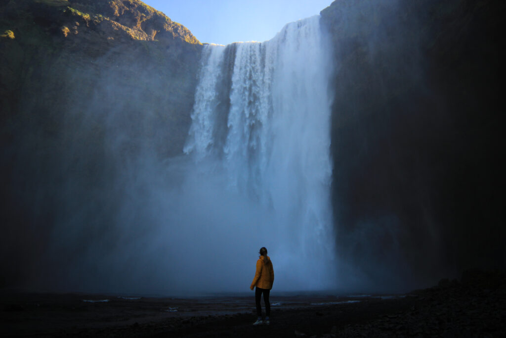
Since we saw the Seljalandsfoss waterfall the evening before, we opted to wake up early and head out by 6:30 am to drive 25 minutes directly to Skogafoss waterfall. This is an extremely popular waterfall for all tourists, so getting here before everyone else if you want nice photos is key! We came here twice – once early in the morning to take photos, and then again on our return trip from Höfn during a busy afternoon to hike the Waterfall Way trail. If you’re visiting in summer months, you can camp here at the parking lot (Skógar campsite = 1,500 ISK per person). There are toilets available for 200 ISK (coins only, but most people don’t pay).
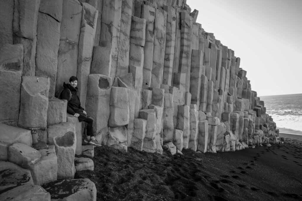
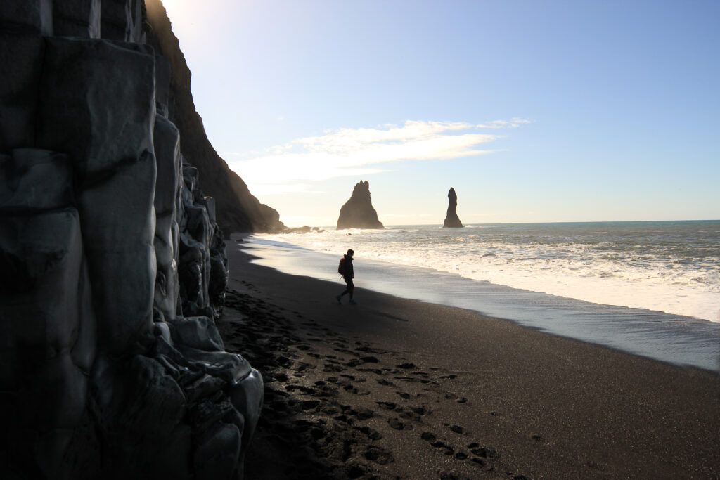
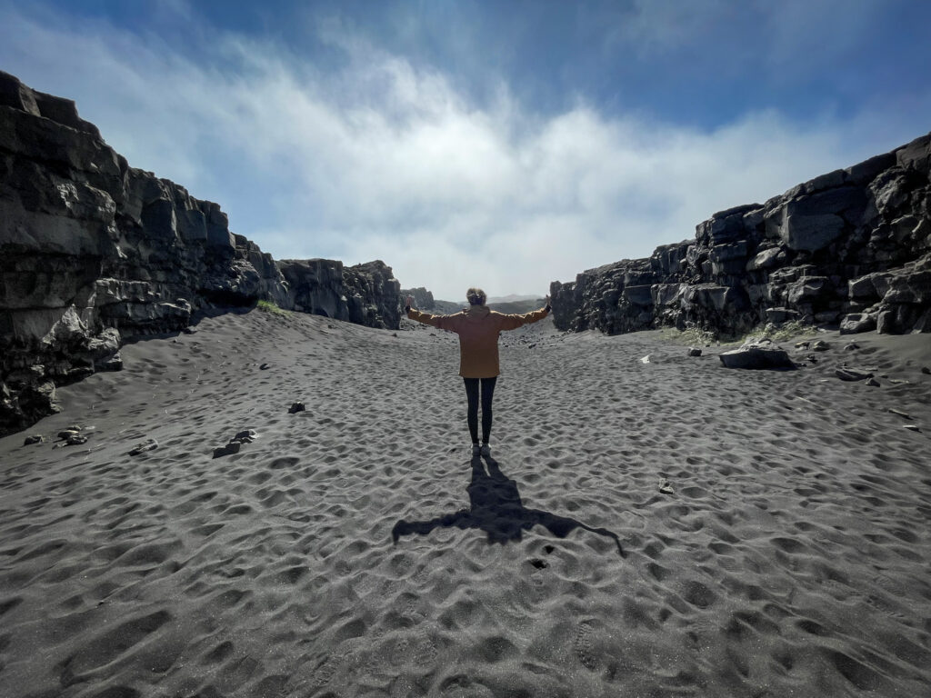
Our next stop on the route was the black sand beach at Reynisfjara Beach outside of Vik. Since we wanted to get here before the beach got crowded, we drove directly from Skogafoss and got here by 9am, just in time for good lighting and empty beaches. By 9:30, the first buses had already started arriving. There are some beautiful basalt columns you can visit while you explore the beach. Just keep an eye on the waves, which can be frighteningly dangerous (sneaker waves) and come out of nowhere – we had some large ones crash near us unexpectedly.
From here, if you’re feeling fit and you have the time, there is a hike you could try near Vik up to the Mýrdalsjökull glacier. It’s about 3.5 hours long (though a bit of a detour from the Ring Road) and looks like a lovely option if the weather holds. Unfortunately, we had to skip it since bad weather was rolling in. You can find more details on the hiking route here.
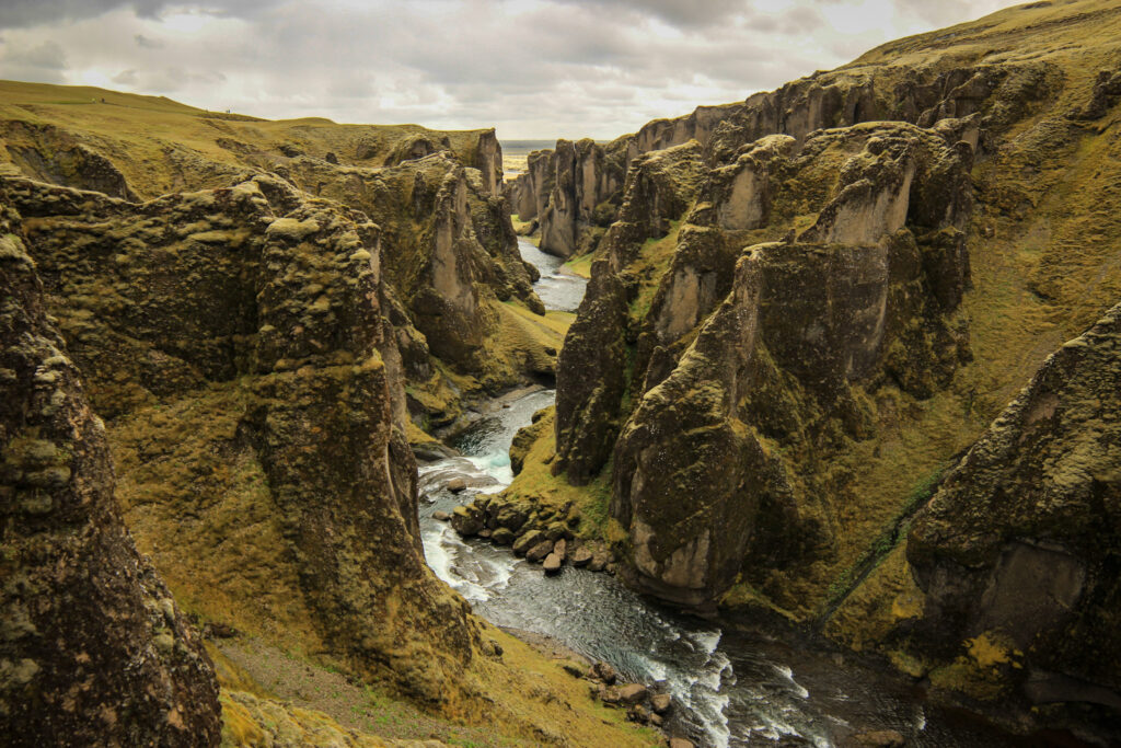
To break up the drive to our next major stop, we detoured to the Fjaðrárgljúfur Canyon. This canyon is a classic example of the effects of overtourism in Iceland. After the Justin Bieber music video (“I’ll show you”) the canyon had to be closed for over a year to give the vegetation a chance to recover. Nowadays, there are limited designated paths you must stick to. These are crowded with people, taking away from the beauty of an otherwise very beautiful natural place. Parking is free (toilets were out of order).
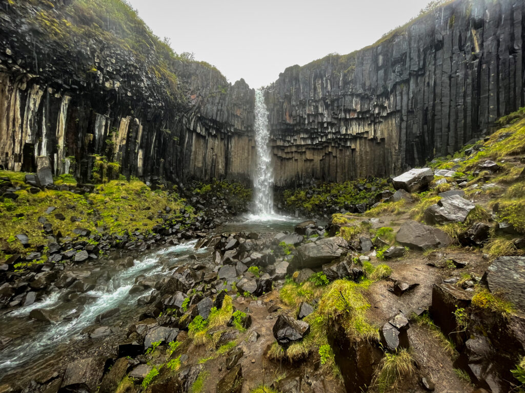
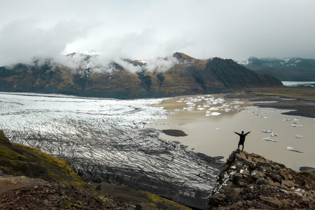
Our next stop was Skaftafell National Park, which was quite a drive from Vik. We spent about 4 hours here. From the visitor centre, we hiked up to the Svartifoss waterfall (the iconic waterfall flowing over basalt columns that inspired the design of the church in Reykjavik). From there we continued uphill to a viewpoint, Sjónarnípa, where we had epic views of the Skaftafellsjökull glacier foot and mountains. From there you follow a trail back to the visitor centre. It was a moderately difficult hike that took about 3 hours with photo stops, mainly because of the torrential downpour for the first hour. The park has a number of hike options that you can choose from depending on your time allowance and will-power.
We also opted to hike the 30 minutes, there and back, to the foot of the glacier. You can skip this. There are a number of roads leading off of the Ring Road that you can drive down to get better access to the glacier than what we saw in Skaftafell.
If you are camping, Skaftafell National Park is a great place to end your day. (Camping is 1800 ISK per person.) For all others, parking at Skaftafell is 750 ISK (pay via the Parka app to avoid the queues at the payment machines – you’ll need your license plate number). Toilets are free. The visitor centre has quite a bit of interesting information on the glaciers.
We drove onwards from here to the small harbour town, Höfn, in hopes that we’d have a sunset view of the Stokksnes mountains (the best angle to photograph them). Unfortunately, the weather didn’t work out so we didn’t see them very clearly. On the plus side, Höfn has different accommodation options available as well as supermarkets where you can restock your snacks supply.
Day 2 on the Ring Road to Selfoss
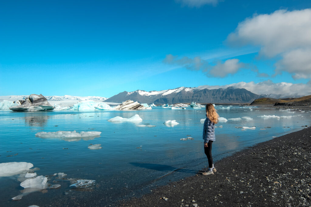
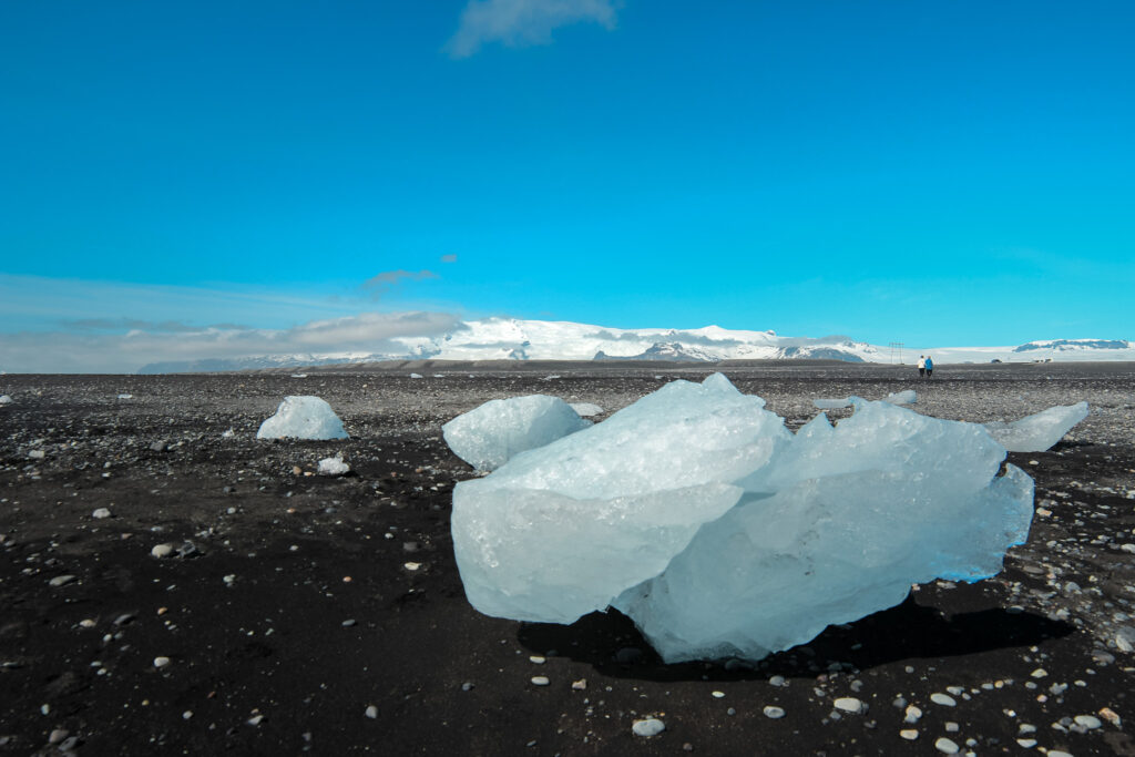
We started our day with an hours drive to Diamond Beach and the Jökulsárlón Iceberg Lagoon. (You can also visit Fjallsárlón lagoon nearby, which has better views of the glacier but smaller icebergs floating around). We spent about 1.5 hours here looking at the various icebergs and even saw one tip over to reveal a very blue underbelly! You can do kayak and boat tours here as well. Parking is free as are restrooms.
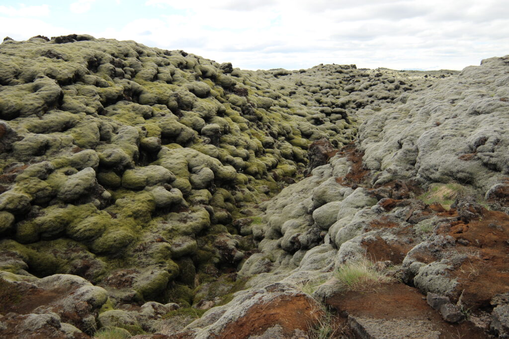
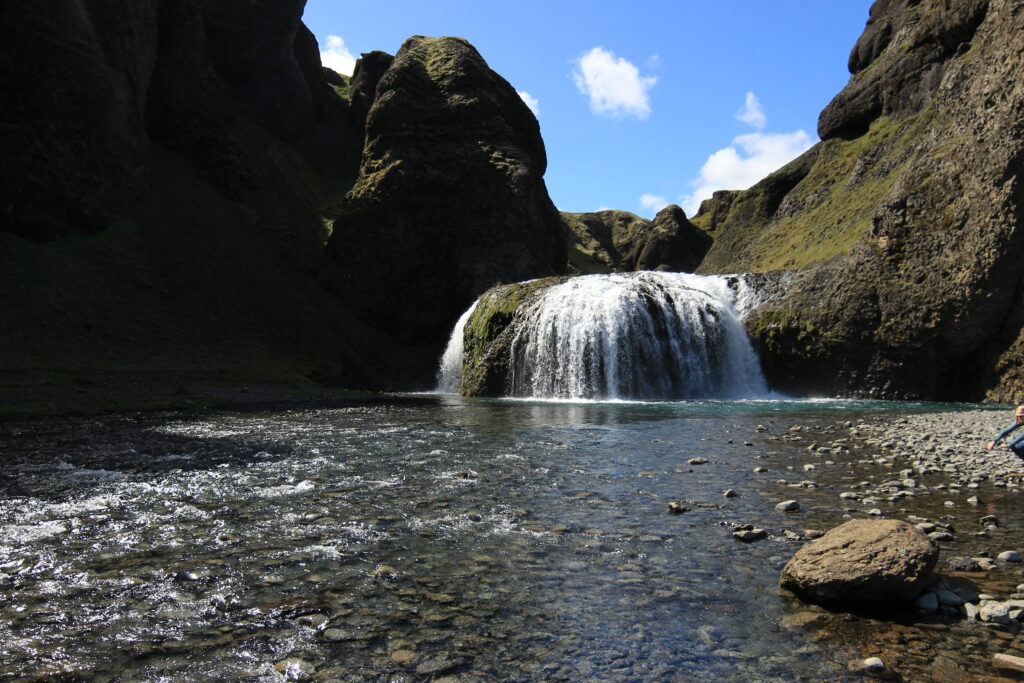
On the drive back to Vik, we stopped at a viewpoint in the moss-covered lava fields (picnic tables are available if you want to stop for lunch), and also at the Stjórnarfoss waterfall. This was a beautiful, relatively empty waterfall that was really nice to relax at. The water isn’t that cold, so if it’s warm outside you can go in. There’s a campsite here that’s open from 1 June to 31 August (750 ISK per person older than 13). It was one of the nicer places we visited mainly because it hadn’t been overwhelmed by overtourism.
After passing Vic, we debated if it was worth paying 750 ISK for parking to visit the Sólheimasandur Plane Wreck, but decided not to once we saw how full the parking lot was. For little more than an instagram shot, it wasn’t worth the time. If you do choose to go, note that the walk looks painfully dull and will take about 2 hours total there and back.
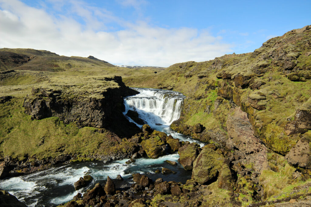
Instead, we chose to return to Skogafoss to do the Waterfall Way hike. The hike starts at the base of the Skogafoss falls and takes you up the wooden stairs to the right of the falls. Simply follow the path as far as your feet will take you. Since we arrived late, we went up to Cascading Falls before turning around. But word on the street is that if you keep going to Subtle Falls, you won’t regret it. For detailed hiking instructions, check out this blog. We really enjoyed this hike because there were very few people along the trail and the canyon and views were stunning. Plus you get to sneak in a few views of the nearby glaciers.
From Skogafoss, we continued on to Selfoss where we spent the night. It wasn’t a bad stopping point because it meant we barely had any driving on our last day in Iceland.
Day 3 on the Ring Road back to Keflavik
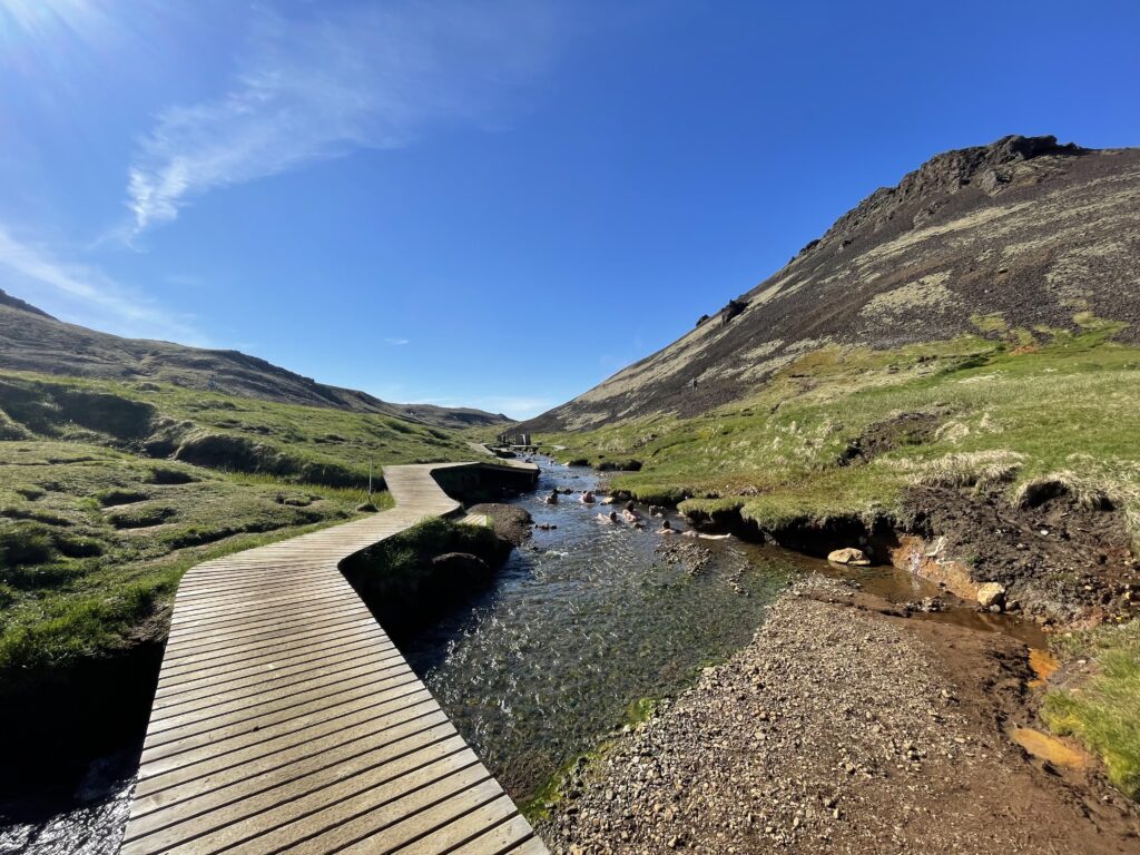
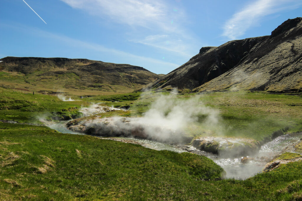
On our final morning we headed to the Reykjadalur (Smokey Valley) Hot Springs Trail. This is a river that is a mix of the hot sulphur springs and cool glacial water, making it ideal bathing temperature. The hike is only about 9km total (2-3 hours depending on your speed). A wooden boardwalk lines the river where the temperatures are safe enough to enjoy without cooking yourself. There are some open changing areas – we brought a towel to do the trick. Further downstream the water is cooler than upstream. It’s a lovely place to relax if there aren’t too many people. If you choose to keep hiking from here, follow the fork to the left to see a lot of bubbling hot spring sources. The steam is intense.
We got there at the Reykjadalur trail start just before 9am. An hour earlier would have been even better to get there before others, but at least we beat the masses. The parking lot was completely full by noon and the river was packed as well. Parking by the cafe at the trail start is 200 ISK for the first hour and 250 per hour after that. There are toilet facilities included. Alternatively, you can park in a lot before the entrance for free and walk a few extra metres to the hike start.
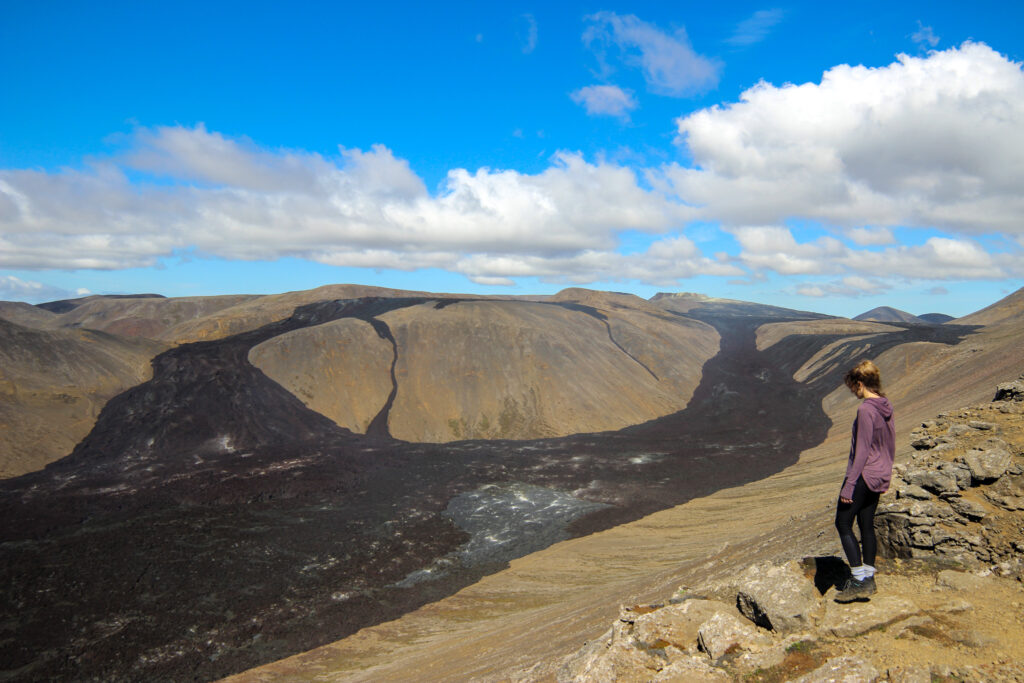
From here, we drove to the Fagradalsfjall Volcano. This was an unexpected highlight on our Iceland trip. The volcano only recently ceased spewing lava, so there was a fresh lava field we could visit up close (it was still smouldering when we visited). You can easily access the lava field from the parking lot (Geldingadalir Volcano Parking 2) within 15 minutes, or you can do a longer hike (~2-3 hours) up to the Langihryggur viewpoint overlooking the lava field and with a good view of a (very dangerous-looking) lip of the volcano.
To drive back to Keflavik, we followed the road 425 around the peninsula. There are a few places you can stop at along the way. We stopped at the Bridge Between Continents, where you can visibly see the divide between the North American and Eurasian tectonic plates. They’re moving apart at a rate of 2cm a year. Hectic.
If you’re looking for tips on how to visit on a tight budget, check out my other post for some tips.